Example of Exploration Geophysics format
Recent searches

Example of Exploration Geophysics format Example of Exploration Geophysics format Example of Exploration Geophysics format Example of Exploration Geophysics format Example of Exploration Geophysics format Example of Exploration Geophysics format Example of Exploration Geophysics format Example of Exploration Geophysics format Example of Exploration Geophysics format Example of Exploration Geophysics format Example of Exploration Geophysics format Example of Exploration Geophysics format Example of Exploration Geophysics format Example of Exploration Geophysics format Example of Exploration Geophysics format Example of Exploration Geophysics format Example of Exploration Geophysics format Example of Exploration Geophysics format Example of Exploration Geophysics format
Sample paper formatted on SciSpace - SciSpace
This content is only for preview purposes. The original open access content can be found here.
Look Inside
Example of Exploration Geophysics format Example of Exploration Geophysics format Example of Exploration Geophysics format Example of Exploration Geophysics format Example of Exploration Geophysics format Example of Exploration Geophysics format Example of Exploration Geophysics format Example of Exploration Geophysics format Example of Exploration Geophysics format Example of Exploration Geophysics format Example of Exploration Geophysics format Example of Exploration Geophysics format Example of Exploration Geophysics format Example of Exploration Geophysics format Example of Exploration Geophysics format Example of Exploration Geophysics format Example of Exploration Geophysics format Example of Exploration Geophysics format Example of Exploration Geophysics format
Sample paper formatted on SciSpace - SciSpace
This content is only for preview purposes. The original open access content can be found here.
open access Open Access

Exploration Geophysics — Template for authors

Publisher: CSIRO Publishing
Categories Rank Trend in last 3 yrs
Geology #132 of 251 down down by 45 ranks
Geophysics #76 of 131 down down by 24 ranks
journal-quality-icon Journal quality:
Medium
calendar-icon Last 4 years overview: 255 Published Papers | 466 Citations
indexed-in-icon Indexed in: Scopus
last-updated-icon Last updated: 10/06/2020
Related journals
Insights
General info
Top papers
Popular templates
Get started guide
Why choose from SciSpace
FAQ

Related Journals

open access Open Access
recommended Recommended

Elsevier

Quality:  
High
CiteRatio: 6.7
SJR: 1.336
SNIP: 1.72
open access Open Access

IOP Publishing

Quality:  
Good
CiteRatio: 3.5
SJR: 0.623
SNIP: 0.85
open access Open Access

Springer

Quality:  
Good
CiteRatio: 2.3
SJR: 0.346
SNIP: 0.88
open access Open Access

Springer

Quality:  
Medium
CiteRatio: 1.2
SJR: 0.437
SNIP: 0.878

Journal Performance & Insights

Impact Factor

CiteRatio

Determines the importance of a journal by taking a measure of frequency with which the average article in a journal has been cited in a particular year.

A measure of average citations received per peer-reviewed paper published in the journal.

0.758

32% from 2018

Impact factor for Exploration Geophysics from 2016 - 2019
Year Value
2019 0.758
2018 1.116
2017 0.95
2016 1.027
graph view Graph view
table view Table view

1.8

20% from 2019

CiteRatio for Exploration Geophysics from 2016 - 2020
Year Value
2020 1.8
2019 1.5
2018 1.9
2017 2.1
2016 1.8
graph view Graph view
table view Table view

insights Insights

  • Impact factor of this journal has decreased by 32% in last year.
  • This journal’s impact factor is in the top 10 percentile category.

insights Insights

  • CiteRatio of this journal has increased by 20% in last years.
  • This journal’s CiteRatio is in the top 10 percentile category.

SCImago Journal Rank (SJR)

Source Normalized Impact per Paper (SNIP)

Measures weighted citations received by the journal. Citation weighting depends on the categories and prestige of the citing journal.

Measures actual citations received relative to citations expected for the journal's category.

0.409

7% from 2019

SJR for Exploration Geophysics from 2016 - 2020
Year Value
2020 0.409
2019 0.441
2018 0.407
2017 0.48
2016 0.652
graph view Graph view
table view Table view

0.596

3% from 2019

SNIP for Exploration Geophysics from 2016 - 2020
Year Value
2020 0.596
2019 0.58
2018 0.702
2017 1.08
2016 1.052
graph view Graph view
table view Table view

insights Insights

  • SJR of this journal has decreased by 7% in last years.
  • This journal’s SJR is in the top 10 percentile category.

insights Insights

  • SNIP of this journal has increased by 3% in last years.
  • This journal’s SNIP is in the top 10 percentile category.

Exploration Geophysics

Guideline source: View

All company, product and service names used in this website are for identification purposes only. All product names, trademarks and registered trademarks are property of their respective owners.

Use of these names, trademarks and brands does not imply endorsement or affiliation. Disclaimer Notice

CSIRO Publishing

Exploration Geophysics

Approved by publishing and review experts on SciSpace, this template is built as per for Exploration Geophysics formatting guidelines as mentioned in CSIRO Publishing author instructions. The current version was created on 10 Jun 2020 and has been used by 842 authors to write and format their manuscripts to this journal.

Geology

Geophysics

Earth and Planetary Sciences

i
Last updated on
10 Jun 2020
i
ISSN
0812-3985
i
Impact Factor
Medium - 0.835
i
Open Access
No
i
Sherpa RoMEO Archiving Policy
Green faq
i
Plagiarism Check
Available via Turnitin
i
Endnote Style
Download Available
i
Bibliography Name
CSIRO Custom Citation
i
Citation Type
Author Year
(Blonder et al., 1982)
i
Bibliography Example
Blonder, G. E., Tinkham, M. and Klapwijk, T. M. (1982). Transition from metallic to tunneling regimes in superconducting microconstrictions: Excess current, charge im-balance, and supercurrent conversion, Phys. Rev. B 25(7), 4515–4532. URL: 10.1103/PhysRevB.25.4515

Top papers written in this journal

open accessOpen access Journal Article DOI: 10.1071/EG03182
A comparison of smooth and blocky inversion methods in 2-D electrical imaging surveys
M. H. Loke, Ian Acworth, Torleif Dahlin
01 Dec 2001 - Exploration Geophysics

Abstract:

Two-dimensional electrical imaging surveys are now widely used in engineering and environmental surveys to map moderately complex structures. In order to adequately resolve such structures with arbitrary resistivity distributions, the regularised least-squares optimisation method with a cell-based model is frequently used in ... Two-dimensional electrical imaging surveys are now widely used in engineering and environmental surveys to map moderately complex structures. In order to adequately resolve such structures with arbitrary resistivity distributions, the regularised least-squares optimisation method with a cell-based model is frequently used in the inversion of the electrical imaging data. The L 2 norm based least-squares optimisation method that attempts to minimise the sum of squares of the spatial changes in the model resistivity is often used. The resulting inversion model has a smooth variation in the resistivity values. In cases where the true subsurface resistivity consists of several regions that are approximately homogenous internally and separated by sharp boundaries, the result obtained by the smooth inversion method is not optimal. It tends to smear out the boundaries and give resistivity values that are too low or too high. The blocky or L 1 norm optimisation method can be used for such situations. This method attempts to minimise the sum of the absolute values of the spatial changes in the model resistivity. It tends to produce models with regions that are piecewise constant and separated by sharp boundaries. Results from tests of the smooth and blocky inversion methods with several synthetic and field data sets highlight the strengths and weaknesses of both methods. The smooth inversion method gives better results for areas where the subsurface resistivity changes in a gradual manner, while the blocky inversion method gives significantly better results where there are sharp boundaries. While fast computers and software have made the task of interpreting data from electrical imaging surveys much easier, it remains the responsibility of the interpreter to choose the appropriate tool for the task based on the available geological information. read more read less
View PDF
775 Citations
open accessOpen access Journal Article DOI: 10.1071/EG984265A
SH-wave propagation in heterogeneous media: velocity-stress finite-difference method
01 Dec 1984 - Exploration Geophysics

Abstract:

A new finite-difference (FD) method is presented for modeling SH-wave propagation in a generally heterogeneous medium. This method uses both velocity and stress in a discrete grid. Density and shear modulus are similarly discretized, avoiding any spatial smoothing. Therefore, boundaries will be correctly modeled under an impl... A new finite-difference (FD) method is presented for modeling SH-wave propagation in a generally heterogeneous medium. This method uses both velocity and stress in a discrete grid. Density and shear modulus are similarly discretized, avoiding any spatial smoothing. Therefore, boundaries will be correctly modeled under an implicit formulation. Standard problems (quarter-plane propagation, sedimentary basin propagation) are studied to compare this method with other methods. Finally a more complex example (a salt dome inside a twolayered medium) shows the effect of lateral propagation on seismograms recorded at the surface. A corner wave, always in-phase with the incident wave, and a head wave will appear, which will pose severe problems of interpretation with the usual vertical migration methods. read more read less

Topics:

Wave propagation (63%)63% related to the paper, Finite difference method (53%)53% related to the paper
View PDF
404 Citations
Journal Article DOI: 10.1071/EG04194
SkyTEM–a New High-resolution Helicopter Transient Electromagnetic System
Kurt Sørensen, Esben Auken1
01 Sep 2004 - Exploration Geophysics

Abstract:

SkyTEM is a time-domain, helicopter electromagnetic system designed for hydrogeophysical and environmental investigation. Developed as a rapid alternative to ground-based, transient electromagnetic measurements, the resolution capabilities are comparable to that of a conventional 40 × 40 m 2 system. Independent of the helicop... SkyTEM is a time-domain, helicopter electromagnetic system designed for hydrogeophysical and environmental investigation. Developed as a rapid alternative to ground-based, transient electromagnetic measurements, the resolution capabilities are comparable to that of a conventional 40 × 40 m 2 system. Independent of the helicopter, the entire system is carried as an external sling load. In the present system, the transmitter, mounted on a lightweight wooden lattice frame, is a four-turn 12.5 × 12.5 m 2 square loop, divided into segments for transmitting a low moment with one turn and a high moment with all four turns. The low moment uses about 30 A with a turn-off time of about 4 µs; the high moment draws approximately 50 A, and has a turn-off time of about 80 µs. The shielded, overdamped, multi-turn receiver loop is rigidly mounted on the side of the transmitter loop. This is essentially a central-loop configuration with a 1.5 m vertical offset. In vertical hover mode the SkyTEM responses were within 2% of those from a conventional ground-based system. Instrument bias level is not a concern as high-altitude tests showed that the background noise level is higher than the instrument bias level. By inverting a sounding from a test site to a standard model and then applying the SkyTEM system parameters to compute the forward response, conventional measurements were within 5% of SkyTEM responses for flight heights of 7.25, 10, and 20 m. Standard field operations include establishment of a repeat base station in the survey area where data are acquired approximately every 1.5 hours, when the helicopter is refuelled, to monitor system stability. Data acquired in a production survey were successful in detecting and delineating a buried-valley structure important in hydrogeophysical investigations. read more read less
354 Citations
Journal Article DOI: 10.1071/EG06102
Reverse-time migration using the Poynting vector
01 Mar 2006 - Exploration Geophysics

Abstract:

Recently, rapid developments in computer hardware have enabled reverse-time migration to be applied to various production imaging problems. As a wave-equation technique using the two-way wave equation, reverse-time migration can handle not only multi-path arrivals but also steep dips and overturned reflections. However, rever... Recently, rapid developments in computer hardware have enabled reverse-time migration to be applied to various production imaging problems. As a wave-equation technique using the two-way wave equation, reverse-time migration can handle not only multi-path arrivals but also steep dips and overturned reflections. However, reverse-time migration causes unwanted artefacts, which arise from the two-way characteristics of the hyperbolic wave equation. Zero-lag cross correlation with diving waves, head waves and back-scattered waves result in spurious artefacts. These strong artefacts have the common feature that the correlating forward and backward wavefields propagate in almost the opposite direction to each other at each correlation point. This is because the ray paths of the forward and backward wavefields are almost identical. In this paper, we present several tactics to avoid artefacts in shot-domain reverse-time migration. Simple muting of a shot gather before migration, or wavefront migration which performs correlation only within a time window following first arriving travel times, are useful in suppressing artefacts. Calculating the wave propagation direction from the Poynting vector gives rise to a new imaging condition, which can eliminate strong artefacts and can produce common image gathers in the reflection angle domain. read more read less

Topics:

Seismic migration (58%)58% related to the paper, Poynting vector (52%)52% related to the paper, Reflection (physics) (51%)51% related to the paper
305 Citations
Journal Article DOI: 10.1071/EG993679
3-D analytic signal in the interpretation of total magnetic field data at low magnetic latitudes
Ian N. MacLeod, Keith Jones, Ting Fan Dai
01 Dec 1993 - Exploration Geophysics

Abstract:

The interpretation of magnetic field data at low magnetic latitudes is difficult because the vector nature of the magnetic field increases the complexity of anomalies from magnetic rocks. The most obvious approach to this problem is to reduce the data to the magnetic pole (RTP), where the presumably vertical magnetisation vec... The interpretation of magnetic field data at low magnetic latitudes is difficult because the vector nature of the magnetic field increases the complexity of anomalies from magnetic rocks. The most obvious approach to this problem is to reduce the data to the magnetic pole (RTP), where the presumably vertical magnetisation vector will simplify observed anomalies. However, RTP requires special treatment of north-south features in data observed in low magnetic latitudes due to high amplitude corrections of such features. Furthermore, RTP requires the assumption of induced magnetisation with the result that anomalies from remanently and anisotropically magnetised bodies can be severely disturbed. The amplitude of the 3-D analytic signal of the total magnetic field produces maxima over magnetic contacts regardless of the direction of magnetisation. The absence of magnetisation direction in the shape of analytic signal anomalies is a particularly attractive characteristic for the interpretation of magnetic field data near the magnetic equator. Although the amplitude of the analytic signal is dependent on magneti­sation strength and the direction of geological strike with respect to the magnetisation vector, this dependency is easier to deal with in the interpretation of analytic signal amplitude than in the original total field data or pole-reduced magnetic field. It is also straightforward to determine the depth to sources from the distance between inflection points of analytic signal anomalies. read more read less

Topics:

Magnetization (56%)56% related to the paper, Magnetic field (55%)55% related to the paper, Analytic signal (52%)52% related to the paper, Magnetic dip (52%)52% related to the paper, Amplitude (51%)51% related to the paper
291 Citations
Author Pic

SciSpace is a very innovative solution to the formatting problem and existing providers, such as Mendeley or Word did not really evolve in recent years.

- Andreas Frutiger, Researcher, ETH Zurich, Institute for Biomedical Engineering

Get MS-Word and LaTeX output to any Journal within seconds
1
Choose a template
Select a template from a library of 40,000+ templates
2
Import a MS-Word file or start fresh
It takes only few seconds to import
3
View and edit your final output
SciSpace will automatically format your output to meet journal guidelines
4
Submit directly or Download
Submit to journal directly or Download in PDF, MS Word or LaTeX

(Before submission check for plagiarism via Turnitin)

clock Less than 3 minutes

What to expect from SciSpace?

Speed and accuracy over MS Word

''

With SciSpace, you do not need a word template for Exploration Geophysics.

It automatically formats your research paper to CSIRO Publishing formatting guidelines and citation style.

You can download a submission ready research paper in pdf, LaTeX and docx formats.

Time comparison

Time taken to format a paper and Compliance with guidelines

Plagiarism Reports via Turnitin

SciSpace has partnered with Turnitin, the leading provider of Plagiarism Check software.

Using this service, researchers can compare submissions against more than 170 million scholarly articles, a database of 70+ billion current and archived web pages. How Turnitin Integration works?

Turnitin Stats
Publisher Logos

Freedom from formatting guidelines

One editor, 100K journal formats – world's largest collection of journal templates

With such a huge verified library, what you need is already there.

publisher-logos

Easy support from all your favorite tools

Exploration Geophysics format uses CSIRO Custom Citation citation style.

Automatically format and order your citations and bibliography in a click.

SciSpace allows imports from all reference managers like Mendeley, Zotero, Endnote, Google Scholar etc.

Frequently asked questions

1. Can I write Exploration Geophysics in LaTeX?

Absolutely not! Our tool has been designed to help you focus on writing. You can write your entire paper as per the Exploration Geophysics guidelines and auto format it.

2. Do you follow the Exploration Geophysics guidelines?

Yes, the template is compliant with the Exploration Geophysics guidelines. Our experts at SciSpace ensure that. If there are any changes to the journal's guidelines, we'll change our algorithm accordingly.

3. Can I cite my article in multiple styles in Exploration Geophysics?

Of course! We support all the top citation styles, such as APA style, MLA style, Vancouver style, Harvard style, and Chicago style. For example, when you write your paper and hit autoformat, our system will automatically update your article as per the Exploration Geophysics citation style.

4. Can I use the Exploration Geophysics templates for free?

Sign up for our free trial, and you'll be able to use all our features for seven days. You'll see how helpful they are and how inexpensive they are compared to other options, Especially for Exploration Geophysics.

5. Can I use a manuscript in Exploration Geophysics that I have written in MS Word?

Yes. You can choose the right template, copy-paste the contents from the word document, and click on auto-format. Once you're done, you'll have a publish-ready paper Exploration Geophysics that you can download at the end.

6. How long does it usually take you to format my papers in Exploration Geophysics?

It only takes a matter of seconds to edit your manuscript. Besides that, our intuitive editor saves you from writing and formatting it in Exploration Geophysics.

7. Where can I find the template for the Exploration Geophysics?

It is possible to find the Word template for any journal on Google. However, why use a template when you can write your entire manuscript on SciSpace , auto format it as per Exploration Geophysics's guidelines and download the same in Word, PDF and LaTeX formats? Give us a try!.

8. Can I reformat my paper to fit the Exploration Geophysics's guidelines?

Of course! You can do this using our intuitive editor. It's very easy. If you need help, our support team is always ready to assist you.

9. Exploration Geophysics an online tool or is there a desktop version?

SciSpace's Exploration Geophysics is currently available as an online tool. We're developing a desktop version, too. You can request (or upvote) any features that you think would be helpful for you and other researchers in the "feature request" section of your account once you've signed up with us.

10. I cannot find my template in your gallery. Can you create it for me like Exploration Geophysics?

Sure. You can request any template and we'll have it setup within a few days. You can find the request box in Journal Gallery on the right side bar under the heading, "Couldn't find the format you were looking for like Exploration Geophysics?”

11. What is the output that I would get after using Exploration Geophysics?

After writing your paper autoformatting in Exploration Geophysics, you can download it in multiple formats, viz., PDF, Docx, and LaTeX.

12. Is Exploration Geophysics's impact factor high enough that I should try publishing my article there?

To be honest, the answer is no. The impact factor is one of the many elements that determine the quality of a journal. Few of these factors include review board, rejection rates, frequency of inclusion in indexes, and Eigenfactor. You need to assess all these factors before you make your final call.

13. What is Sherpa RoMEO Archiving Policy for Exploration Geophysics?

SHERPA/RoMEO Database

We extracted this data from Sherpa Romeo to help researchers understand the access level of this journal in accordance with the Sherpa Romeo Archiving Policy for Exploration Geophysics. The table below indicates the level of access a journal has as per Sherpa Romeo's archiving policy.

RoMEO Colour Archiving policy
Green Can archive pre-print and post-print or publisher's version/PDF
Blue Can archive post-print (ie final draft post-refereeing) or publisher's version/PDF
Yellow Can archive pre-print (ie pre-refereeing)
White Archiving not formally supported
FYI:
  1. Pre-prints as being the version of the paper before peer review and
  2. Post-prints as being the version of the paper after peer-review, with revisions having been made.

14. What are the most common citation types In Exploration Geophysics?

The 5 most common citation types in order of usage for Exploration Geophysics are:.

S. No. Citation Style Type
1. Author Year
2. Numbered
3. Numbered (Superscripted)
4. Author Year (Cited Pages)
5. Footnote

15. How do I submit my article to the Exploration Geophysics?

It is possible to find the Word template for any journal on Google. However, why use a template when you can write your entire manuscript on SciSpace , auto format it as per Exploration Geophysics's guidelines and download the same in Word, PDF and LaTeX formats? Give us a try!.

16. Can I download Exploration Geophysics in Endnote format?

Yes, SciSpace provides this functionality. After signing up, you would need to import your existing references from Word or Bib file to SciSpace. Then SciSpace would allow you to download your references in Exploration Geophysics Endnote style according to Elsevier guidelines.

Fast and reliable,
built for complaince.

Instant formatting to 100% publisher guidelines on - SciSpace.
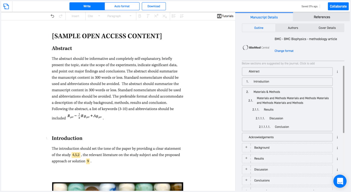
Available only on desktops 🖥

No word template required

Typset automatically formats your research paper to Exploration Geophysics formatting guidelines and citation style.
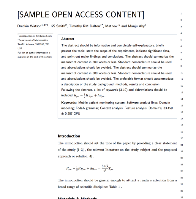
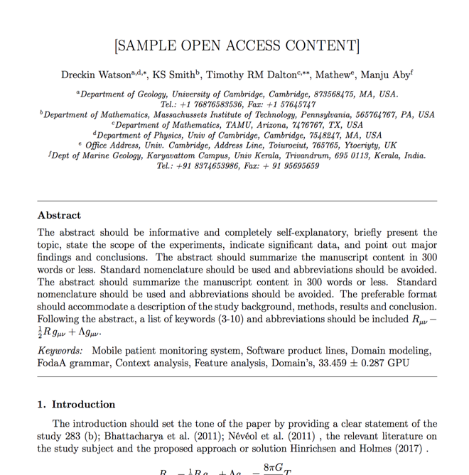
Verifed journal formats

One editor, 100K journal formats.
With the largest collection of verified journal formats, what you need is already there.

Trusted by academicians

I spent hours with MS word for reformatting. It was frustrating - plain and simple. With SciSpace, I can draft my manuscripts and once it is finished I can just submit. In case, I have to submit to another journal it is really just a button click instead of an afternoon of reformatting.

Andreas Frutiger
Researcher & Ex MS Word user
Use this template