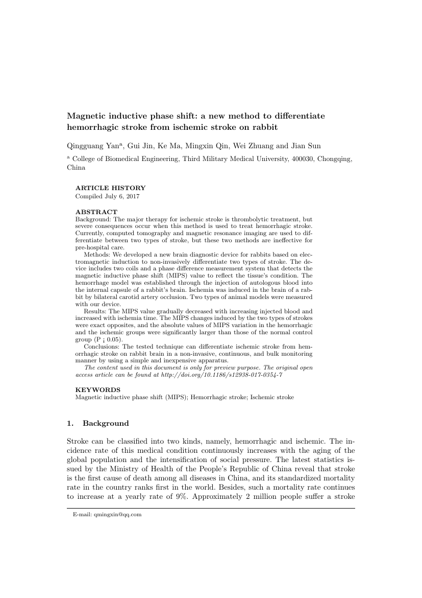
Example of Cartography and Geographic Information Science format
Recent searches

Example of Cartography and Geographic Information Science format Example of Cartography and Geographic Information Science format Example of Cartography and Geographic Information Science format Example of Cartography and Geographic Information Science format Example of Cartography and Geographic Information Science format Example of Cartography and Geographic Information Science format Example of Cartography and Geographic Information Science format Example of Cartography and Geographic Information Science format Example of Cartography and Geographic Information Science format Example of Cartography and Geographic Information Science format Example of Cartography and Geographic Information Science format Example of Cartography and Geographic Information Science format
Sample paper formatted on SciSpace - SciSpace
This content is only for preview purposes. The original open access content can be found here.
Look Inside
Example of Cartography and Geographic Information Science format Example of Cartography and Geographic Information Science format Example of Cartography and Geographic Information Science format Example of Cartography and Geographic Information Science format Example of Cartography and Geographic Information Science format Example of Cartography and Geographic Information Science format Example of Cartography and Geographic Information Science format Example of Cartography and Geographic Information Science format Example of Cartography and Geographic Information Science format Example of Cartography and Geographic Information Science format Example of Cartography and Geographic Information Science format Example of Cartography and Geographic Information Science format
Sample paper formatted on SciSpace - SciSpace
This content is only for preview purposes. The original open access content can be found here.
open access Open Access
recommended Recommended

Cartography and Geographic Information Science — Template for authors

Publisher: Taylor and Francis
Categories Rank Trend in last 3 yrs
Geography, Planning and Development #49 of 704 up up by 7 ranks
Management of Technology and Innovation #36 of 248 -
Civil and Structural Engineering #47 of 318 down down by 7 ranks
journal-quality-icon Journal quality:
High
calendar-icon Last 4 years overview: 152 Published Papers | 863 Citations
indexed-in-icon Indexed in: Scopus
last-updated-icon Last updated: 28/06/2020
Related journals
Insights
General info
Top papers
Popular templates
Get started guide
Why choose from SciSpace
FAQ

Related Journals

open access Open Access

Springer

Quality:  
High
CiteRatio: 3.3
SJR: 0.522
SNIP: 1.289
open access Open Access
recommended Recommended

Elsevier

Quality:  
High
CiteRatio: 10.7
SJR: 1.645
SNIP: 2.347
open access Open Access
recommended Recommended

Elsevier

Quality:  
High
CiteRatio: 9.7
SJR: 1.736
SNIP: 2.36

Journal Performance & Insights

Impact Factor

CiteRatio

Determines the importance of a journal by taking a measure of frequency with which the average article in a journal has been cited in a particular year.

A measure of average citations received per peer-reviewed paper published in the journal.

2.429

7% from 2018

Impact factor for Cartography and Geographic Information Science from 2016 - 2019
Year Value
2019 2.429
2018 2.271
2017 1.785
2016 2.391
graph view Graph view
table view Table view

5.7

24% from 2019

CiteRatio for Cartography and Geographic Information Science from 2016 - 2020
Year Value
2020 5.7
2019 4.6
2018 3.8
2017 4.3
2016 4.7
graph view Graph view
table view Table view

insights Insights

  • Impact factor of this journal has increased by 7% in last year.
  • This journal’s impact factor is in the top 10 percentile category.

insights Insights

  • CiteRatio of this journal has increased by 24% in last years.
  • This journal’s CiteRatio is in the top 10 percentile category.

SCImago Journal Rank (SJR)

Source Normalized Impact per Paper (SNIP)

Measures weighted citations received by the journal. Citation weighting depends on the categories and prestige of the citing journal.

Measures actual citations received relative to citations expected for the journal's category.

0.751

8% from 2019

SJR for Cartography and Geographic Information Science from 2016 - 2020
Year Value
2020 0.751
2019 0.814
2018 0.682
2017 0.837
2016 1.139
graph view Graph view
table view Table view

1.702

5% from 2019

SNIP for Cartography and Geographic Information Science from 2016 - 2020
Year Value
2020 1.702
2019 1.622
2018 1.586
2017 1.508
2016 1.817
graph view Graph view
table view Table view

insights Insights

  • SJR of this journal has decreased by 8% in last years.
  • This journal’s SJR is in the top 10 percentile category.

insights Insights

  • SNIP of this journal has increased by 5% in last years.
  • This journal’s SNIP is in the top 10 percentile category.

Cartography and Geographic Information Science

Guideline source: View

All company, product and service names used in this website are for identification purposes only. All product names, trademarks and registered trademarks are property of their respective owners.

Use of these names, trademarks and brands does not imply endorsement or affiliation. Disclaimer Notice

Taylor and Francis

Cartography and Geographic Information Science

Cartography and Geographic Information Science (CaGIS) is the official publication of the Cartography and Geographic Information Society. The Society supports research, education, and practices that improve the understanding, creation, analysis, and use of maps and geographic ...... Read More

Geography, Planning and Development

Civil and Structural Engineering

Management of Technology and Innovation

Social Sciences

i
Last updated on
28 Jun 2020
i
ISSN
1523-0406
i
Impact Factor
High - 2.391
i
Acceptance Rate
Not provided
i
Frequency
6 issues per year
i
Open Access
Yes
i
Sherpa RoMEO Archiving Policy
Green faq
i
Plagiarism Check
Available via Turnitin
i
Endnote Style
Download Available
i
Bibliography Name
Taylor and Francis Custom Citation
i
Citation Type
Numbered
[25]
i
Bibliography Example
Blonder GE, Tinkham M, Klapwijk TM. Transition from metallic to tunneling regimes in superconducting microconstrictions: Excess current, charge imbalance, and supercurrent conversion. Phys Rev B. 1982; 25(7):4515–4532. Available from: 10.1103/PhysRevB.25.4515.

Top papers written in this journal

Journal Article DOI: 10.1559/152304001782173970
Research challenges in geovisualization
Alan M. MacEachren1, Menno-Jan Kraak

Abstract:

(2001). Research Challenges in Geovisualization. Cartography and Geographic Information Science: Vol. 28, No. 1, pp. 3-12.

Topics:

Geovisualization (68%)68% related to the paper
637 Citations
open accessOpen access Journal Article DOI: 10.1080/15230406.2014.890072
Geo-located Twitter as proxy for global mobility patterns
Bartosz Hawelka1, Izabela Sitko1, Euro Beinat2, Stanislav Sobolevsky1, Pavlos Kazakopoulos2, Carlo Ratti1

Abstract:

Pervasive presence of location-sharing services made it possible for researchers to gain an unprecedented access to the direct records of human activity in space and time. This article analyses geo... Pervasive presence of location-sharing services made it possible for researchers to gain an unprecedented access to the direct records of human activity in space and time. This article analyses geo... read more read less
View PDF
634 Citations
Journal Article DOI: 10.1559/1523040054738936
Visualizing Geospatial Information Uncertainty: What We Know and What We Need to Know

Abstract:

Developing reliable methods for representing and managing information uncertainty remains a persistent and relevant challenge to GIScience. Information uncertainty is an intricate idea, and recent examinations of this concept have generated many perspectives on its representation and visualization, with perspectives emerging ... Developing reliable methods for representing and managing information uncertainty remains a persistent and relevant challenge to GIScience. Information uncertainty is an intricate idea, and recent examinations of this concept have generated many perspectives on its representation and visualization, with perspectives emerging from a wide range of disciplines and application contexts. In this paper, we review and assess progress toward visual tools and methods to help analysts manage and understand information uncertainty. Specifically, we report on efforts to conceptualize uncertainty, decision making with uncertainty, frameworks for representing uncertainty, visual representation and user control of displays of information uncertainty, and evaluative efforts to assess the use and usability of visual displays of uncertainty. We conclude by identifying seven key research challenges in visualizing information uncertainty, particularly as it applies to decision making and analysis. read more read less

Topics:

Theory of Motivated Information Management (62%)62% related to the paper, Need to know (52%)52% related to the paper, Geovisualization (51%)51% related to the paper, Geospatial analysis (50%)50% related to the paper
View PDF
540 Citations
Journal Article DOI: 10.1559/152304001782173727
Dasymetric Mapping and Areal Interpolation: Implementation and Evaluation

Abstract:

Dasymetric maps display statistical data in meaningful spatial zones Such maps can be preferable to choropleth maps that show data by enumeration zones, because dasymetric zones more accurately represent underlying data distributions Though dasymetric mapping has existed for well over a century, the methods for producing thes... Dasymetric maps display statistical data in meaningful spatial zones Such maps can be preferable to choropleth maps that show data by enumeration zones, because dasymetric zones more accurately represent underlying data distributions Though dasymetric mapping has existed for well over a century, the methods for producing these maps have not been thoroughly examined In contrast, research on areal interpolation has been more thorough and has examined methods of transferring data from one set of map zones to another, an issue that is applicable to dasymetric mapping Inspired by this work, we tested five dasymetric mapping methods, including methods derived from work on areal interpolation Dasymetric maps of six socio-economic variables were produced fm a study area of 159 counties in the eastern US using county choropleth data and ancillary land-use data Both polygonal (vector) and grid (raster) dasymetric methods were tested We evaluated map accuracy using both statistical analyses and visual prese read more read less

Topics:

Dasymetric map (79%)79% related to the paper, Choropleth map (62%)62% related to the paper
481 Citations
Journal Article DOI: 10.1559/152304003100011090
Geodesic Discrete Global Grid Systems
Kevin Sahr, Denis White1, A. Jon Kimerling2

Abstract:

In recent years, a number of data structures for global geo-referenced data sets have been proposed based on regular, multi-resolution partitions of polyhedra. We present a survey of the most promising of such systems, which we call Geodesic Discrete Global Grid Systems (Geodesic DGGSs). We show that Geodesic DGGS alternative... In recent years, a number of data structures for global geo-referenced data sets have been proposed based on regular, multi-resolution partitions of polyhedra. We present a survey of the most promising of such systems, which we call Geodesic Discrete Global Grid Systems (Geodesic DGGSs). We show that Geodesic DGGS alternatives can be constructed by specifying five substantially independent design choices: a base regular polyhedron, a fixed orientation of the base regular polyhedron relative to the Earth, a hierarchical spatial partitioning method defined symmetrically on a face (or set of faces) of the base regular polyhedron, a method for transforming that planar partition to the corresponding spherical/ellipsoidal surface, and a method for assigning point representations to grid cells. The majority of systems surveyed are based on the icosahedron, use an aperture 4 triangle or hexagon partition, and are either created directly on the surface of the sphere or by using an equal-area transformation. An exa... read more read less

Topics:

Regular polyhedron (62%)62% related to the paper, Polyhedron (60%)60% related to the paper, Geodesic (57%)57% related to the paper
View PDF
456 Citations
Author Pic

SciSpace is a very innovative solution to the formatting problem and existing providers, such as Mendeley or Word did not really evolve in recent years.

- Andreas Frutiger, Researcher, ETH Zurich, Institute for Biomedical Engineering

Get MS-Word and LaTeX output to any Journal within seconds
1
Choose a template
Select a template from a library of 40,000+ templates
2
Import a MS-Word file or start fresh
It takes only few seconds to import
3
View and edit your final output
SciSpace will automatically format your output to meet journal guidelines
4
Submit directly or Download
Submit to journal directly or Download in PDF, MS Word or LaTeX

(Before submission check for plagiarism via Turnitin)

clock Less than 3 minutes

What to expect from SciSpace?

Speed and accuracy over MS Word

''

With SciSpace, you do not need a word template for Cartography and Geographic Information Science.

It automatically formats your research paper to Taylor and Francis formatting guidelines and citation style.

You can download a submission ready research paper in pdf, LaTeX and docx formats.

Time comparison

Time taken to format a paper and Compliance with guidelines

Plagiarism Reports via Turnitin

SciSpace has partnered with Turnitin, the leading provider of Plagiarism Check software.

Using this service, researchers can compare submissions against more than 170 million scholarly articles, a database of 70+ billion current and archived web pages. How Turnitin Integration works?

Turnitin Stats
Publisher Logos

Freedom from formatting guidelines

One editor, 100K journal formats – world's largest collection of journal templates

With such a huge verified library, what you need is already there.

publisher-logos

Easy support from all your favorite tools

Cartography and Geographic Information Science format uses Taylor and Francis Custom Citation citation style.

Automatically format and order your citations and bibliography in a click.

SciSpace allows imports from all reference managers like Mendeley, Zotero, Endnote, Google Scholar etc.

Frequently asked questions

1. Can I write Cartography and Geographic Information Science in LaTeX?

Absolutely not! Our tool has been designed to help you focus on writing. You can write your entire paper as per the Cartography and Geographic Information Science guidelines and auto format it.

2. Do you follow the Cartography and Geographic Information Science guidelines?

Yes, the template is compliant with the Cartography and Geographic Information Science guidelines. Our experts at SciSpace ensure that. If there are any changes to the journal's guidelines, we'll change our algorithm accordingly.

3. Can I cite my article in multiple styles in Cartography and Geographic Information Science?

Of course! We support all the top citation styles, such as APA style, MLA style, Vancouver style, Harvard style, and Chicago style. For example, when you write your paper and hit autoformat, our system will automatically update your article as per the Cartography and Geographic Information Science citation style.

4. Can I use the Cartography and Geographic Information Science templates for free?

Sign up for our free trial, and you'll be able to use all our features for seven days. You'll see how helpful they are and how inexpensive they are compared to other options, Especially for Cartography and Geographic Information Science.

5. Can I use a manuscript in Cartography and Geographic Information Science that I have written in MS Word?

Yes. You can choose the right template, copy-paste the contents from the word document, and click on auto-format. Once you're done, you'll have a publish-ready paper Cartography and Geographic Information Science that you can download at the end.

6. How long does it usually take you to format my papers in Cartography and Geographic Information Science?

It only takes a matter of seconds to edit your manuscript. Besides that, our intuitive editor saves you from writing and formatting it in Cartography and Geographic Information Science.

7. Where can I find the template for the Cartography and Geographic Information Science?

It is possible to find the Word template for any journal on Google. However, why use a template when you can write your entire manuscript on SciSpace , auto format it as per Cartography and Geographic Information Science's guidelines and download the same in Word, PDF and LaTeX formats? Give us a try!.

8. Can I reformat my paper to fit the Cartography and Geographic Information Science's guidelines?

Of course! You can do this using our intuitive editor. It's very easy. If you need help, our support team is always ready to assist you.

9. Cartography and Geographic Information Science an online tool or is there a desktop version?

SciSpace's Cartography and Geographic Information Science is currently available as an online tool. We're developing a desktop version, too. You can request (or upvote) any features that you think would be helpful for you and other researchers in the "feature request" section of your account once you've signed up with us.

10. I cannot find my template in your gallery. Can you create it for me like Cartography and Geographic Information Science?

Sure. You can request any template and we'll have it setup within a few days. You can find the request box in Journal Gallery on the right side bar under the heading, "Couldn't find the format you were looking for like Cartography and Geographic Information Science?”

11. What is the output that I would get after using Cartography and Geographic Information Science?

After writing your paper autoformatting in Cartography and Geographic Information Science, you can download it in multiple formats, viz., PDF, Docx, and LaTeX.

12. Is Cartography and Geographic Information Science's impact factor high enough that I should try publishing my article there?

To be honest, the answer is no. The impact factor is one of the many elements that determine the quality of a journal. Few of these factors include review board, rejection rates, frequency of inclusion in indexes, and Eigenfactor. You need to assess all these factors before you make your final call.

13. What is Sherpa RoMEO Archiving Policy for Cartography and Geographic Information Science?

SHERPA/RoMEO Database

We extracted this data from Sherpa Romeo to help researchers understand the access level of this journal in accordance with the Sherpa Romeo Archiving Policy for Cartography and Geographic Information Science. The table below indicates the level of access a journal has as per Sherpa Romeo's archiving policy.

RoMEO Colour Archiving policy
Green Can archive pre-print and post-print or publisher's version/PDF
Blue Can archive post-print (ie final draft post-refereeing) or publisher's version/PDF
Yellow Can archive pre-print (ie pre-refereeing)
White Archiving not formally supported
FYI:
  1. Pre-prints as being the version of the paper before peer review and
  2. Post-prints as being the version of the paper after peer-review, with revisions having been made.

14. What are the most common citation types In Cartography and Geographic Information Science?

The 5 most common citation types in order of usage for Cartography and Geographic Information Science are:.

S. No. Citation Style Type
1. Author Year
2. Numbered
3. Numbered (Superscripted)
4. Author Year (Cited Pages)
5. Footnote

15. How do I submit my article to the Cartography and Geographic Information Science?

It is possible to find the Word template for any journal on Google. However, why use a template when you can write your entire manuscript on SciSpace , auto format it as per Cartography and Geographic Information Science's guidelines and download the same in Word, PDF and LaTeX formats? Give us a try!.

16. Can I download Cartography and Geographic Information Science in Endnote format?

Yes, SciSpace provides this functionality. After signing up, you would need to import your existing references from Word or Bib file to SciSpace. Then SciSpace would allow you to download your references in Cartography and Geographic Information Science Endnote style according to Elsevier guidelines.

Fast and reliable,
built for complaince.

Instant formatting to 100% publisher guidelines on - SciSpace.
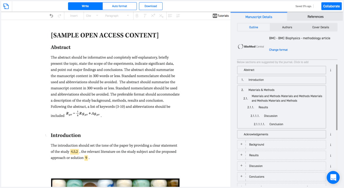
Available only on desktops 🖥

No word template required

Typset automatically formats your research paper to Cartography and Geographic Information Science formatting guidelines and citation style.
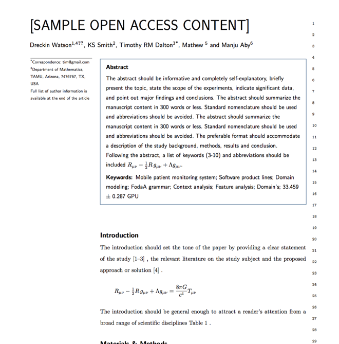

Verifed journal formats

One editor, 100K journal formats.
With the largest collection of verified journal formats, what you need is already there.

Trusted by academicians

I spent hours with MS word for reformatting. It was frustrating - plain and simple. With SciSpace, I can draft my manuscripts and once it is finished I can just submit. In case, I have to submit to another journal it is really just a button click instead of an afternoon of reformatting.

Andreas Frutiger
Researcher & Ex MS Word user
Use this template