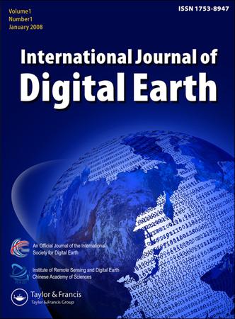
Example of International Journal of Digital Earth format
Recent searches

Example of International Journal of Digital Earth format Example of International Journal of Digital Earth format Example of International Journal of Digital Earth format Example of International Journal of Digital Earth format Example of International Journal of Digital Earth format Example of International Journal of Digital Earth format
Sample paper formatted on SciSpace - SciSpace
This content is only for preview purposes. The original open access content can be found here.
Look Inside
Example of International Journal of Digital Earth format Example of International Journal of Digital Earth format Example of International Journal of Digital Earth format Example of International Journal of Digital Earth format Example of International Journal of Digital Earth format Example of International Journal of Digital Earth format
Sample paper formatted on SciSpace - SciSpace
This content is only for preview purposes. The original open access content can be found here.
open access Open Access
recommended Recommended

International Journal of Digital Earth — Template for authors

Publisher: Taylor and Francis
Categories Rank Trend in last 3 yrs
Earth and Planetary Sciences (all) #17 of 186 up up by 2 ranks
Computer Science Applications #116 of 693 down down by 2 ranks
Software #85 of 389 up up by 11 ranks
journal-quality-icon Journal quality:
High
calendar-icon Last 4 years overview: 300 Published Papers | 1977 Citations
indexed-in-icon Indexed in: Scopus
last-updated-icon Last updated: 12/07/2020
Related journals
Insights
General info
Top papers
Popular templates
Get started guide
Why choose from SciSpace
FAQ

Related Journals

open access Open Access
recommended Recommended

Taylor and Francis

Quality:  
High
CiteRatio: 6.8
SJR: 1.321
SNIP: 1.764
open access Open Access
recommended Recommended

IEEE

Quality:  
High
CiteRatio: 10.8
SJR: 1.075
SNIP: 2.756
open access Open Access
recommended Recommended

IEEE

Quality:  
High
CiteRatio: 19.8
SJR: 2.882
SNIP: 3.86
open access Open Access
recommended Recommended

IEEE

Quality:  
High
CiteRatio: 6.7
SJR: 0.534
SNIP: 1.463

Journal Performance & Insights

Impact Factor

CiteRatio

Determines the importance of a journal by taking a measure of frequency with which the average article in a journal has been cited in a particular year.

A measure of average citations received per peer-reviewed paper published in the journal.

3.097

22% from 2018

Impact factor for International Journal of Digital Earth from 2016 - 2019
Year Value
2019 3.097
2018 3.985
2017 2.746
2016 2.292
graph view Graph view
table view Table view

6.6

8% from 2019

CiteRatio for International Journal of Digital Earth from 2016 - 2020
Year Value
2020 6.6
2019 7.2
2018 5.6
2017 4.7
2016 5.5
graph view Graph view
table view Table view

insights Insights

  • Impact factor of this journal has decreased by 22% in last year.
  • This journal’s impact factor is in the top 10 percentile category.

insights Insights

  • CiteRatio of this journal has decreased by 8% in last years.
  • This journal’s CiteRatio is in the top 10 percentile category.

SCImago Journal Rank (SJR)

Source Normalized Impact per Paper (SNIP)

Measures weighted citations received by the journal. Citation weighting depends on the categories and prestige of the citing journal.

Measures actual citations received relative to citations expected for the journal's category.

0.813

25% from 2019

SJR for International Journal of Digital Earth from 2016 - 2020
Year Value
2020 0.813
2019 1.084
2018 1.116
2017 0.728
2016 0.92
graph view Graph view
table view Table view

1.434

5% from 2019

SNIP for International Journal of Digital Earth from 2016 - 2020
Year Value
2020 1.434
2019 1.513
2018 1.58
2017 1.223
2016 1.459
graph view Graph view
table view Table view

insights Insights

  • SJR of this journal has decreased by 25% in last years.
  • This journal’s SJR is in the top 10 percentile category.

insights Insights

  • SNIP of this journal has decreased by 5% in last years.
  • This journal’s SNIP is in the top 10 percentile category.
International Journal of Digital Earth

Guideline source: View

All company, product and service names used in this website are for identification purposes only. All product names, trademarks and registered trademarks are property of their respective owners.

Use of these names, trademarks and brands does not imply endorsement or affiliation. Disclaimer Notice

Taylor and Francis

International Journal of Digital Earth

Approved by publishing and review experts on SciSpace, this template is built as per for International Journal of Digital Earth formatting guidelines as mentioned in Taylor and Francis author instructions. The current version was created on 12 Jul 2020 and has been used by 613 authors to write and format their manuscripts to this journal.

Earth and Planetary Sciences

i
Last updated on
12 Jul 2020
i
ISSN
1753-8947
i
Impact Factor
High - 1.83
i
Open Access
No
i
Sherpa RoMEO Archiving Policy
Green faq
i
Plagiarism Check
Available via Turnitin
i
Endnote Style
Download Available
i
Bibliography Name
Taylor and Francis Custom Citation
i
Citation Type
Numbered
[25]
i
Bibliography Example
Blonder GE, Tinkham M, Klapwijk TM. Transition from metallic to tunneling regimes in superconducting microconstrictions: Excess current, charge imbalance, and supercurrent conversion. Phys Rev B. 1982; 25(7):4515–4532. Available from: 10.1103/PhysRevB.25.4515.

Top papers written in this journal

Journal Article DOI: 10.1080/17538941003759255
Crowdsourcing geographic information for disaster response: a research frontier
Michael F. Goodchild1, J. Alan Glennon1

Abstract:

Geographic data and tools are essential in all aspects of emergency management: preparedness, response, recovery, and mitigation. Geographic information created by amateur citizens, often known as volunteered geographic information, has recently provided an interesting alternative to traditional authoritative information from... Geographic data and tools are essential in all aspects of emergency management: preparedness, response, recovery, and mitigation. Geographic information created by amateur citizens, often known as volunteered geographic information, has recently provided an interesting alternative to traditional authoritative information from mapping agencies and corporations, and several recent papers have provided the beginnings of a literature on the more fundamental issues raised by this new source. Data quality is a major concern, since volunteered information is asserted and carries none of the assurances that lead to trust in officially created data. During emergencies time is the essence, and the risks associated with volunteered information are often outweighed by the benefits of its use. An example is discussed using the four wildfires that impacted the Santa Barbara area in 2007–2009, and lessons are drawn. read more read less

Topics:

Volunteered geographic information (63%)63% related to the paper, Neogeography (59%)59% related to the paper, Preparedness (53%)53% related to the paper, Emergency management (52%)52% related to the paper, Crowdsourcing (51%)51% related to the paper
View PDF
824 Citations
open accessOpen access Journal Article DOI: 10.1080/17538947.2013.786146
Global, 30-m resolution continuous fields of tree cover: Landsat-based rescaling of MODIS vegetation continuous fields with lidar-based estimates of error

Abstract:

We developed a global, 30-m resolution dataset of percent tree cover by rescaling the 250-m MOderate-resolution Imaging Spectroradiometer (MODIS) Vegetation Continuous Fields (VCF) Tree Cover layer using circa- 2000 and 2005 Landsat images, incorporating the MODIS Cropland Layer to improve accuracy in agricultural areas Resul... We developed a global, 30-m resolution dataset of percent tree cover by rescaling the 250-m MOderate-resolution Imaging Spectroradiometer (MODIS) Vegetation Continuous Fields (VCF) Tree Cover layer using circa- 2000 and 2005 Landsat images, incorporating the MODIS Cropland Layer to improve accuracy in agricultural areas Resulting Landsat-based estimates maintained consistency with the MODIS VCF in both epochs (RMSE =86% in 2000 and 119% in 2005), but showed improved accuracy in agricultural areas and increased discrimination of small forest patches Against lidar measurements, the Landsat-based estimates exhibited accuracy slightly less than that of the MODIS VCF (RMSE=168% for MODIS-based vs 174% for Landsat-based estimates), but RMSE of Landsat estimates was 33 percentage points lower than that of the MODIS data in an agricultural region The Landsat data retained the saturation artifact of the MODIS VCF at greater than or equal to 80% tree cover but showed greater potential for removal read more read less
View PDF
582 Citations
open accessOpen access Journal Article DOI: 10.1080/17538947.2016.1239771
Big Data and cloud computing: innovation opportunities and challenges
Chaowei Yang1, Qunying Huang2, Zhenlong Li3, Kai Liu1, Fei Hu1

Abstract:

Big Data has emerged in the past few years as a new paradigm providing abundant data and opportunities to improve and/or enable research and decision-support applications with unprecedented value for digital earth applications including business, sciences and engineering. At the same time, Big Data presents challenges for dig... Big Data has emerged in the past few years as a new paradigm providing abundant data and opportunities to improve and/or enable research and decision-support applications with unprecedented value for digital earth applications including business, sciences and engineering. At the same time, Big Data presents challenges for digital earth to store, transport, process, mine and serve the data. Cloud computing provides fundamental support to address the challenges with shared computing resources including computing, storage, networking and analytical software; the application of these resources has fostered impressive Big Data advancements. This paper surveys the two frontiers – Big Data and cloud computing – and reviews the advantages and consequences of utilizing cloud computing to tackling Big Data in the digital earth and relevant science domains. From the aspects of a general introduction, sources, challenges, technology status and research opportunities, the following observations are offered: (i... read more read less

Topics:

Cloud computing (63%)63% related to the paper, Big data (58%)58% related to the paper, Digital Earth (55%)55% related to the paper
View PDF
545 Citations
Journal Article DOI: 10.1080/17538947.2014.990526
A survey of remote sensing-based aboveground biomass estimation methods in forest ecosystems
Dengsheng Lu1, Qi Chen2, Guangxing Wang3, Lijuan Liu, Guiying Li1, Emilio F. Moran1

Abstract:

Remote sensing-based methods of aboveground biomass (AGB) estimation in forest ecosystems have gained increased attention, and substantial research has been conducted in the past three decades. This paper provides a survey of current biomass estimation methods using remote sensing data and discusses four critical issues – col... Remote sensing-based methods of aboveground biomass (AGB) estimation in forest ecosystems have gained increased attention, and substantial research has been conducted in the past three decades. This paper provides a survey of current biomass estimation methods using remote sensing data and discusses four critical issues – collection of field-based biomass reference data, extraction and selection of suitable variables from remote sensing data, identification of proper algorithms to develop biomass estimation models, and uncertainty analysis to refine the estimation procedure. Additionally, we discuss the impacts of scales on biomass estimation performance and describe a general biomass estimation procedure. Although optical sensor and radar data have been primary sources for AGB estimation, data saturation is an important factor resulting in estimation uncertainty. LIght Detection and Ranging (lidar) can remove data saturation, but limited availability of lidar data prevents its extensive application. This... read more read less
462 Citations
Journal Article DOI: 10.1080/17538947.2013.805262
A long-term Global LAnd Surface Satellite (GLASS) data-set for environmental studies

Abstract:

Recently, five Global LAnd Surface Satellite (GLASS) products have been released: leaf area index (LAI), shortwave broadband albedo, longwave broadband emissivity, incident short radiation, and pho... Recently, five Global LAnd Surface Satellite (GLASS) products have been released: leaf area index (LAI), shortwave broadband albedo, longwave broadband emissivity, incident short radiation, and pho... read more read less

Topics:

Longwave (53%)53% related to the paper, Shortwave (53%)53% related to the paper, Albedo (52%)52% related to the paper, Emissivity (52%)52% related to the paper, Leaf area index (50%)50% related to the paper
View PDF
391 Citations
Author Pic

SciSpace is a very innovative solution to the formatting problem and existing providers, such as Mendeley or Word did not really evolve in recent years.

- Andreas Frutiger, Researcher, ETH Zurich, Institute for Biomedical Engineering

Get MS-Word and LaTeX output to any Journal within seconds
1
Choose a template
Select a template from a library of 40,000+ templates
2
Import a MS-Word file or start fresh
It takes only few seconds to import
3
View and edit your final output
SciSpace will automatically format your output to meet journal guidelines
4
Submit directly or Download
Submit to journal directly or Download in PDF, MS Word or LaTeX

(Before submission check for plagiarism via Turnitin)

clock Less than 3 minutes

What to expect from SciSpace?

Speed and accuracy over MS Word

''

With SciSpace, you do not need a word template for International Journal of Digital Earth.

It automatically formats your research paper to Taylor and Francis formatting guidelines and citation style.

You can download a submission ready research paper in pdf, LaTeX and docx formats.

Time comparison

Time taken to format a paper and Compliance with guidelines

Plagiarism Reports via Turnitin

SciSpace has partnered with Turnitin, the leading provider of Plagiarism Check software.

Using this service, researchers can compare submissions against more than 170 million scholarly articles, a database of 70+ billion current and archived web pages. How Turnitin Integration works?


Turnitin Stats
Publisher Logos

Freedom from formatting guidelines

One editor, 100K journal formats – world's largest collection of journal templates

With such a huge verified library, what you need is already there.

publisher-logos

Easy support from all your favorite tools

International Journal of Digital Earth format uses Taylor and Francis Custom Citation citation style.

Automatically format and order your citations and bibliography in a click.

SciSpace allows imports from all reference managers like Mendeley, Zotero, Endnote, Google Scholar etc.

Frequently asked questions

1. Can I write International Journal of Digital Earth in LaTeX?

Absolutely not! Our tool has been designed to help you focus on writing. You can write your entire paper as per the International Journal of Digital Earth guidelines and auto format it.

2. Do you follow the International Journal of Digital Earth guidelines?

Yes, the template is compliant with the International Journal of Digital Earth guidelines. Our experts at SciSpace ensure that. If there are any changes to the journal's guidelines, we'll change our algorithm accordingly.

3. Can I cite my article in multiple styles in International Journal of Digital Earth?

Of course! We support all the top citation styles, such as APA style, MLA style, Vancouver style, Harvard style, and Chicago style. For example, when you write your paper and hit autoformat, our system will automatically update your article as per the International Journal of Digital Earth citation style.

4. Can I use the International Journal of Digital Earth templates for free?

Sign up for our free trial, and you'll be able to use all our features for seven days. You'll see how helpful they are and how inexpensive they are compared to other options, Especially for International Journal of Digital Earth.

5. Can I use a manuscript in International Journal of Digital Earth that I have written in MS Word?

Yes. You can choose the right template, copy-paste the contents from the word document, and click on auto-format. Once you're done, you'll have a publish-ready paper International Journal of Digital Earth that you can download at the end.

6. How long does it usually take you to format my papers in International Journal of Digital Earth?

It only takes a matter of seconds to edit your manuscript. Besides that, our intuitive editor saves you from writing and formatting it in International Journal of Digital Earth.

7. Where can I find the template for the International Journal of Digital Earth?

It is possible to find the Word template for any journal on Google. However, why use a template when you can write your entire manuscript on SciSpace , auto format it as per International Journal of Digital Earth's guidelines and download the same in Word, PDF and LaTeX formats? Give us a try!.

8. Can I reformat my paper to fit the International Journal of Digital Earth's guidelines?

Of course! You can do this using our intuitive editor. It's very easy. If you need help, our support team is always ready to assist you.

9. International Journal of Digital Earth an online tool or is there a desktop version?

SciSpace's International Journal of Digital Earth is currently available as an online tool. We're developing a desktop version, too. You can request (or upvote) any features that you think would be helpful for you and other researchers in the "feature request" section of your account once you've signed up with us.

10. I cannot find my template in your gallery. Can you create it for me like International Journal of Digital Earth?

Sure. You can request any template and we'll have it setup within a few days. You can find the request box in Journal Gallery on the right side bar under the heading, "Couldn't find the format you were looking for like International Journal of Digital Earth?”

11. What is the output that I would get after using International Journal of Digital Earth?

After writing your paper autoformatting in International Journal of Digital Earth, you can download it in multiple formats, viz., PDF, Docx, and LaTeX.

12. Is International Journal of Digital Earth's impact factor high enough that I should try publishing my article there?

To be honest, the answer is no. The impact factor is one of the many elements that determine the quality of a journal. Few of these factors include review board, rejection rates, frequency of inclusion in indexes, and Eigenfactor. You need to assess all these factors before you make your final call.

13. What is Sherpa RoMEO Archiving Policy for International Journal of Digital Earth?

SHERPA/RoMEO Database

We extracted this data from Sherpa Romeo to help researchers understand the access level of this journal in accordance with the Sherpa Romeo Archiving Policy for International Journal of Digital Earth. The table below indicates the level of access a journal has as per Sherpa Romeo's archiving policy.

RoMEO Colour Archiving policy
Green Can archive pre-print and post-print or publisher's version/PDF
Blue Can archive post-print (ie final draft post-refereeing) or publisher's version/PDF
Yellow Can archive pre-print (ie pre-refereeing)
White Archiving not formally supported
FYI:
  1. Pre-prints as being the version of the paper before peer review and
  2. Post-prints as being the version of the paper after peer-review, with revisions having been made.

14. What are the most common citation types In International Journal of Digital Earth?

The 5 most common citation types in order of usage for International Journal of Digital Earth are:.

S. No. Citation Style Type
1. Author Year
2. Numbered
3. Numbered (Superscripted)
4. Author Year (Cited Pages)
5. Footnote

15. How do I submit my article to the International Journal of Digital Earth?

It is possible to find the Word template for any journal on Google. However, why use a template when you can write your entire manuscript on SciSpace , auto format it as per International Journal of Digital Earth's guidelines and download the same in Word, PDF and LaTeX formats? Give us a try!.

16. Can I download International Journal of Digital Earth in Endnote format?

Yes, SciSpace provides this functionality. After signing up, you would need to import your existing references from Word or Bib file to SciSpace. Then SciSpace would allow you to download your references in International Journal of Digital Earth Endnote style according to Elsevier guidelines.

Fast and reliable,
built for complaince.

Instant formatting to 100% publisher guidelines on - SciSpace.
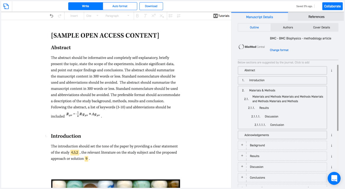
Available only on desktops 🖥

No word template required

Typset automatically formats your research paper to International Journal of Digital Earth formatting guidelines and citation style.
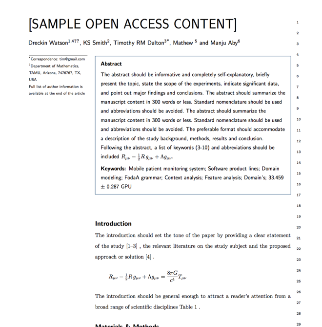
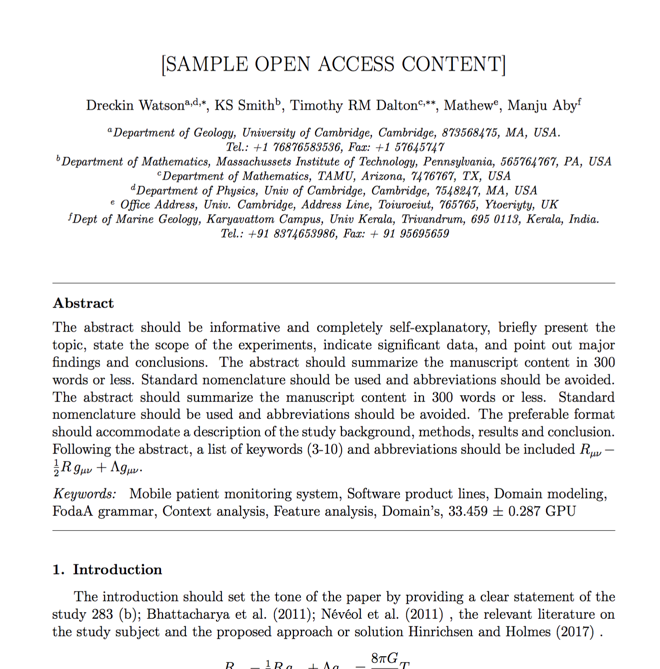
Verifed journal formats

One editor, 100K journal formats.
With the largest collection of verified journal formats, what you need is already there.

Trusted by academicians

I spent hours with MS word for reformatting. It was frustrating - plain and simple. With SciSpace, I can draft my manuscripts and once it is finished I can just submit. In case, I have to submit to another journal it is really just a button click instead of an afternoon of reformatting.

Andreas Frutiger
Researcher & Ex MS Word user
Use this template