Example of Transactions in GIS format
Recent searches

Example of Transactions in GIS format Example of Transactions in GIS format Example of Transactions in GIS format Example of Transactions in GIS format Example of Transactions in GIS format Example of Transactions in GIS format Example of Transactions in GIS format
Sample paper formatted on SciSpace - SciSpace
This content is only for preview purposes. The original open access content can be found here.
Look Inside
Example of Transactions in GIS format Example of Transactions in GIS format Example of Transactions in GIS format Example of Transactions in GIS format Example of Transactions in GIS format Example of Transactions in GIS format Example of Transactions in GIS format
Sample paper formatted on SciSpace - SciSpace
This content is only for preview purposes. The original open access content can be found here.
open access Open Access

Transactions in GIS — Template for authors

Publisher: Wiley
Categories Rank Trend in last 3 yrs
Earth and Planetary Sciences (all) #29 of 186 down down by 4 ranks
journal-quality-icon Journal quality:
High
calendar-icon Last 4 years overview: 311 Published Papers | 1422 Citations
indexed-in-icon Indexed in: Scopus
last-updated-icon Last updated: 06/07/2020
Related journals
Insights
General info
Top papers
Popular templates
Get started guide
Why choose from SciSpace
FAQ

Related Journals

open access Open Access

Taylor and Francis

Quality:  
High
CiteRatio: 4.1
SJR: 0.694
SNIP: 0.72
open access Open Access
recommended Recommended

Taylor and Francis

Quality:  
High
CiteRatio: 6.6
SJR: 0.813
SNIP: 1.434
open access Open Access
recommended Recommended

Springer

Quality:  
High
CiteRatio: 7.2
SJR: 1.148
SNIP: 1.68
open access Open Access
recommended Recommended

IEEE

Quality:  
High
CiteRatio: 15.5
SJR: 3.038
SNIP: 7.166

Journal Performance & Insights

Impact Factor

CiteRatio

Determines the importance of a journal by taking a measure of frequency with which the average article in a journal has been cited in a particular year.

A measure of average citations received per peer-reviewed paper published in the journal.

2.119

3% from 2018

Impact factor for Transactions in GIS from 2016 - 2019
Year Value
2019 2.119
2018 2.188
2017 1.91
2016 2.252
graph view Graph view
table view Table view

4.6

12% from 2019

CiteRatio for Transactions in GIS from 2016 - 2020
Year Value
2020 4.6
2019 4.1
2018 3.8
2017 4.0
2016 4.2
graph view Graph view
table view Table view

insights Insights

  • Impact factor of this journal has decreased by 3% in last year.
  • This journal’s impact factor is in the top 10 percentile category.

insights Insights

  • CiteRatio of this journal has increased by 12% in last years.
  • This journal’s CiteRatio is in the top 10 percentile category.

SCImago Journal Rank (SJR)

Source Normalized Impact per Paper (SNIP)

Measures weighted citations received by the journal. Citation weighting depends on the categories and prestige of the citing journal.

Measures actual citations received relative to citations expected for the journal's category.

0.721

12% from 2019

SJR for Transactions in GIS from 2016 - 2020
Year Value
2020 0.721
2019 0.645
2018 0.739
2017 0.723
2016 1.0
graph view Graph view
table view Table view

1.131

8% from 2019

SNIP for Transactions in GIS from 2016 - 2020
Year Value
2020 1.131
2019 1.235
2018 1.496
2017 1.312
2016 1.701
graph view Graph view
table view Table view

insights Insights

  • SJR of this journal has increased by 12% in last years.
  • This journal’s SJR is in the top 10 percentile category.

insights Insights

  • SNIP of this journal has decreased by 8% in last years.
  • This journal’s SNIP is in the top 10 percentile category.

Transactions in GIS

Guideline source: View

All company, product and service names used in this website are for identification purposes only. All product names, trademarks and registered trademarks are property of their respective owners.

Use of these names, trademarks and brands does not imply endorsement or affiliation. Disclaimer Notice

Wiley

Transactions in GIS

Transactions in GIS is an international journal which provides a forum for high quality, original research articles, review articles and short notes that focus on: practical and theoretical issues influencing the development of GISthe collection, analysis, modelling, interpret...... Read More

Earth and Planetary Sciences

i
Last updated on
05 Jul 2020
i
ISSN
1361-1682
i
Impact Factor
High - 1.274
i
Open Access
Yes
i
Sherpa RoMEO Archiving Policy
Yellow faq
i
Plagiarism Check
Available via Turnitin
i
Endnote Style
Download Available
i
Bibliography Name
apa
i
Citation Type
Numbered
[25]
i
Bibliography Example
Beenakker, C.W.J. (2006) Specular andreev reflection in graphene.Phys. Rev. Lett., 97 (6), 067 007. URL 10.1103/PhysRevLett.97.067007.

Top papers written in this journal

Journal Article DOI: 10.1111/tgis.13010
Taking stock
01 Dec 2022 - Transactions in Gis
6,462 Citations
open accessOpen access Journal Article DOI: 10.1111/J.1467-9671.2010.01203.X
Quality Assessment of the French OpenStreetMap Dataset
01 Aug 2010 - Transactions in Gis

Abstract:

The concept of Volunteered Geographic Information (VGI) has recently emerged from the new Web 2.0 technologies. The OpenStreetMap project is currently the most significant example of a system based on VGI. It aims at producing free vector geographic databases using contributions from Internet users. Spatial data quality becom... The concept of Volunteered Geographic Information (VGI) has recently emerged from the new Web 2.0 technologies. The OpenStreetMap project is currently the most significant example of a system based on VGI. It aims at producing free vector geographic databases using contributions from Internet users. Spatial data quality becomes a key consideration in this context of freely downloadable geographic databases. This article studies the quality of French OpenStreetMap data. It extends the work of Haklay to France, provides a larger set of spatial data quality element assessments (i.e. geometric, attribute, semantic and temporal accuracy, logical consistency, completeness, lineage, and usage), and uses different methods of quality control. The outcome of the study raises questions such as the heterogeneity of processes, scales of production, and the compliance to standardized and accepted specifications. In order to improve data quality, a balance has to be struck between the contributors' freedom and their respect of specifications. The development of appropriate solutions to provide this balance is an important research issue in the domain of user-generated content. read more read less

Topics:

Volunteered geographic information (72%)72% related to the paper, Data quality (58%)58% related to the paper, Quality (business) (51%)51% related to the paper
View PDF
631 Citations
Journal Article DOI: 10.1111/1467-9671.00109
Using Ontologies for Integrated Geographic Information Systems
Frederico T. Fonseca1, Max J. Egenhofer2, Peggy Agouris2, Gilberto Camara3
01 Jun 2002 - Transactions in Gis

Abstract:

Today, there is a huge amount of data gathered about the Earth, not only from new spatial information systems, but also from new and more sophisticated data collection technologies. This scenario leads to a number of interesting research challenges, such as how to integrate geographic information of different kinds. The basic... Today, there is a huge amount of data gathered about the Earth, not only from new spatial information systems, but also from new and more sophisticated data collection technologies. This scenario leads to a number of interesting research challenges, such as how to integrate geographic information of different kinds. The basic motivation of this paper is to introduce a GIS architecture that can enable geographic information integration in a seamless and flexible way based on its semantic value and regardless of its representation. The proposed solution is an ontology-driven geographic information system that acts as a system integrator. In this system, an ontology is a component, such as the database, cooperating to fulfill the system’s objectives. By browsing through ontologies the users can be provided with information about the embedded knowledge of the system. Special emphasis is given to the case of remote sensing systems and geographic information systems. The levels of ontologies can be used to guide processes for the extraction of more general or more detailed information. The use of multiple ontologies allows the extraction of information in different stages of classification. The semantic integration of aerial images and GIS is a crucial step towards better geospatial modeling. read more read less

Topics:

Enterprise GIS (66%)66% related to the paper, Geospatial analysis (66%)66% related to the paper, GIS and public health (64%)64% related to the paper, Information integration (63%)63% related to the paper, Geographic information system (62%)62% related to the paper
View PDF
498 Citations
Journal Article DOI: 10.1111/J.1467-9671.2009.01152.X
Accuracy of iPhone Locations: A Comparison of Assisted GPS, WiFi and Cellular Positioning
Paul A. Zandbergen1
26 Jun 2009 - Transactions in Gis

Abstract:

The 3G iPhone was the first consumer device to provide a seamless integration of three positioning technologies: Assisted GPS (A-GPS), WiFi positioning and cellular network positioning. This study presents an evaluation of the accuracy of locations obtained using these three positioning modes on the 3G iPhone. A-GPS locations... The 3G iPhone was the first consumer device to provide a seamless integration of three positioning technologies: Assisted GPS (A-GPS), WiFi positioning and cellular network positioning. This study presents an evaluation of the accuracy of locations obtained using these three positioning modes on the 3G iPhone. A-GPS locations were validated using surveyed benchmarks and compared to a traditional low-cost GPS receiver running simultaneously. WiFi and cellular positions for indoor locations were validated using high resolution orthophotography. Results indicate that A-GPS locations obtained using the 3G iPhone are much less accurate than those from regular autonomous GPS units (average median error of 8 m for ten 20-minute field tests) but appear sufficient for most Location Based Services (LBS). WiFi locations using the 3G iPhone are much less accurate (median error of 74 m for 58 observations) and fail to meet the published accuracy specifications. Positional errors in WiFi also reveal erratic spatial patterns resulting from the design of the calibration effort underlying the WiFi positioning system. Cellular positioning using the 3G iPhone is the least accurate positioning method (median error of 600 m for 64 observations), consistent with previous studies. Pros and cons of the three positioning technologies are presented in terms of coverage, accuracy and reliability, followed by a discussion of the implications for LBS using the 3G iPhone and similar mobile devices. read more read less

Topics:

Hybrid positioning system (63%)63% related to the paper, Assisted GPS (62%)62% related to the paper, Positioning system (58%)58% related to the paper, Global Positioning System (54%)54% related to the paper
View PDF
451 Citations
Journal Article DOI: 10.1111/J.1467-9671.2012.01359.X
#Earthquake: Twitter as a Distributed Sensor System
Andrew Crooks1, Arie Croitoru1, Anthony Stefanidis1, Jacek Radzikowski1
01 Feb 2013 - Transactions in Gis

Abstract:

Social media feeds are rapidly emerging as a novel avenue for the contribution and dissemination of information that is often geographic. Their content often includes references to events occurring at, or affecting specific locations. Within this article we analyze the spatial and temporal characteristics of the twitter feed ... Social media feeds are rapidly emerging as a novel avenue for the contribution and dissemination of information that is often geographic. Their content often includes references to events occurring at, or affecting specific locations. Within this article we analyze the spatial and temporal characteristics of the twitter feed activity responding to a 5.8 magnitude earthquake which occurred on the East Coast of the United States (US) on August 23, 2011. We argue that these feeds represent a hybrid form of a sensor system that allows for the identification and localization of the impact area of the event. By contrasting this with comparable content collected through the dedicated crowdsourcing ‘Did You Feel It?’ (DYFI) website of the U.S. Geological Survey we assess the potential of the use of harvested social media content for event monitoring. The experiments support the notion that people act as sensors to give us comparable results in a timely manner, and can complement other sources of data to enhance our situational awareness and improve our understanding and response to such events. read more read less

Topics:

Social media (53%)53% related to the paper, Crowdsourcing (51%)51% related to the paper
433 Citations
Author Pic

SciSpace is a very innovative solution to the formatting problem and existing providers, such as Mendeley or Word did not really evolve in recent years.

- Andreas Frutiger, Researcher, ETH Zurich, Institute for Biomedical Engineering

Get MS-Word and LaTeX output to any Journal within seconds
1
Choose a template
Select a template from a library of 40,000+ templates
2
Import a MS-Word file or start fresh
It takes only few seconds to import
3
View and edit your final output
SciSpace will automatically format your output to meet journal guidelines
4
Submit directly or Download
Submit to journal directly or Download in PDF, MS Word or LaTeX

(Before submission check for plagiarism via Turnitin)

clock Less than 3 minutes

What to expect from SciSpace?

Speed and accuracy over MS Word

''

With SciSpace, you do not need a word template for Transactions in GIS.

It automatically formats your research paper to Wiley formatting guidelines and citation style.

You can download a submission ready research paper in pdf, LaTeX and docx formats.

Time comparison

Time taken to format a paper and Compliance with guidelines

Plagiarism Reports via Turnitin

SciSpace has partnered with Turnitin, the leading provider of Plagiarism Check software.

Using this service, researchers can compare submissions against more than 170 million scholarly articles, a database of 70+ billion current and archived web pages. How Turnitin Integration works?


Turnitin Stats
Publisher Logos

Freedom from formatting guidelines

One editor, 100K journal formats – world's largest collection of journal templates

With such a huge verified library, what you need is already there.

publisher-logos

Easy support from all your favorite tools

Transactions in GIS format uses apa citation style.

Automatically format and order your citations and bibliography in a click.

SciSpace allows imports from all reference managers like Mendeley, Zotero, Endnote, Google Scholar etc.

Frequently asked questions

1. Can I write Transactions in GIS in LaTeX?

Absolutely not! Our tool has been designed to help you focus on writing. You can write your entire paper as per the Transactions in GIS guidelines and auto format it.

2. Do you follow the Transactions in GIS guidelines?

Yes, the template is compliant with the Transactions in GIS guidelines. Our experts at SciSpace ensure that. If there are any changes to the journal's guidelines, we'll change our algorithm accordingly.

3. Can I cite my article in multiple styles in Transactions in GIS?

Of course! We support all the top citation styles, such as APA style, MLA style, Vancouver style, Harvard style, and Chicago style. For example, when you write your paper and hit autoformat, our system will automatically update your article as per the Transactions in GIS citation style.

4. Can I use the Transactions in GIS templates for free?

Sign up for our free trial, and you'll be able to use all our features for seven days. You'll see how helpful they are and how inexpensive they are compared to other options, Especially for Transactions in GIS.

5. Can I use a manuscript in Transactions in GIS that I have written in MS Word?

Yes. You can choose the right template, copy-paste the contents from the word document, and click on auto-format. Once you're done, you'll have a publish-ready paper Transactions in GIS that you can download at the end.

6. How long does it usually take you to format my papers in Transactions in GIS?

It only takes a matter of seconds to edit your manuscript. Besides that, our intuitive editor saves you from writing and formatting it in Transactions in GIS.

7. Where can I find the template for the Transactions in GIS?

It is possible to find the Word template for any journal on Google. However, why use a template when you can write your entire manuscript on SciSpace , auto format it as per Transactions in GIS's guidelines and download the same in Word, PDF and LaTeX formats? Give us a try!.

8. Can I reformat my paper to fit the Transactions in GIS's guidelines?

Of course! You can do this using our intuitive editor. It's very easy. If you need help, our support team is always ready to assist you.

9. Transactions in GIS an online tool or is there a desktop version?

SciSpace's Transactions in GIS is currently available as an online tool. We're developing a desktop version, too. You can request (or upvote) any features that you think would be helpful for you and other researchers in the "feature request" section of your account once you've signed up with us.

10. I cannot find my template in your gallery. Can you create it for me like Transactions in GIS?

Sure. You can request any template and we'll have it setup within a few days. You can find the request box in Journal Gallery on the right side bar under the heading, "Couldn't find the format you were looking for like Transactions in GIS?”

11. What is the output that I would get after using Transactions in GIS?

After writing your paper autoformatting in Transactions in GIS, you can download it in multiple formats, viz., PDF, Docx, and LaTeX.

12. Is Transactions in GIS's impact factor high enough that I should try publishing my article there?

To be honest, the answer is no. The impact factor is one of the many elements that determine the quality of a journal. Few of these factors include review board, rejection rates, frequency of inclusion in indexes, and Eigenfactor. You need to assess all these factors before you make your final call.

13. What is Sherpa RoMEO Archiving Policy for Transactions in GIS?

SHERPA/RoMEO Database

We extracted this data from Sherpa Romeo to help researchers understand the access level of this journal in accordance with the Sherpa Romeo Archiving Policy for Transactions in GIS. The table below indicates the level of access a journal has as per Sherpa Romeo's archiving policy.

RoMEO Colour Archiving policy
Green Can archive pre-print and post-print or publisher's version/PDF
Blue Can archive post-print (ie final draft post-refereeing) or publisher's version/PDF
Yellow Can archive pre-print (ie pre-refereeing)
White Archiving not formally supported
FYI:
  1. Pre-prints as being the version of the paper before peer review and
  2. Post-prints as being the version of the paper after peer-review, with revisions having been made.

14. What are the most common citation types In Transactions in GIS?

The 5 most common citation types in order of usage for Transactions in GIS are:.

S. No. Citation Style Type
1. Author Year
2. Numbered
3. Numbered (Superscripted)
4. Author Year (Cited Pages)
5. Footnote

15. How do I submit my article to the Transactions in GIS?

It is possible to find the Word template for any journal on Google. However, why use a template when you can write your entire manuscript on SciSpace , auto format it as per Transactions in GIS's guidelines and download the same in Word, PDF and LaTeX formats? Give us a try!.

16. Can I download Transactions in GIS in Endnote format?

Yes, SciSpace provides this functionality. After signing up, you would need to import your existing references from Word or Bib file to SciSpace. Then SciSpace would allow you to download your references in Transactions in GIS Endnote style according to Elsevier guidelines.

Fast and reliable,
built for complaince.

Instant formatting to 100% publisher guidelines on - SciSpace.
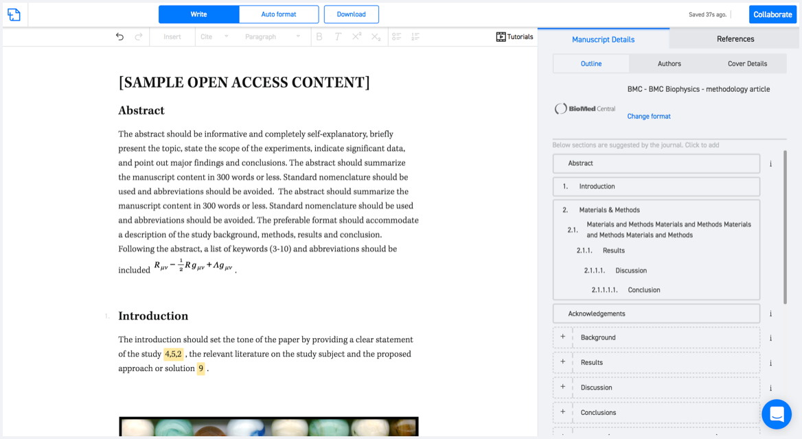
Available only on desktops 🖥

No word template required

Typset automatically formats your research paper to Transactions in GIS formatting guidelines and citation style.
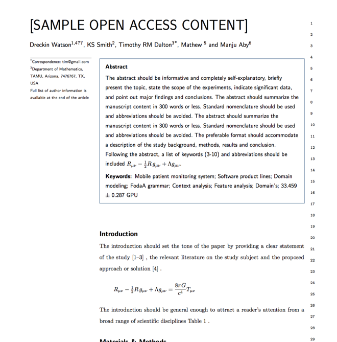

Verifed journal formats

One editor, 100K journal formats.
With the largest collection of verified journal formats, what you need is already there.

Trusted by academicians

I spent hours with MS word for reformatting. It was frustrating - plain and simple. With SciSpace, I can draft my manuscripts and once it is finished I can just submit. In case, I have to submit to another journal it is really just a button click instead of an afternoon of reformatting.

Andreas Frutiger
Researcher & Ex MS Word user
Use this template