
All figures (15)

Figure 8. Data collection sites in the City of London (GoogleTM earth) 
Figure 7. Example City of London, street and building types (GoogleTM earth) 
Figure 4: LB-3DMA algorithm scoring strategy 
Figure 9. The 3D model of City of London used in the experiments (data courtesy of Ordnance Survey) 
TABLE III. DETAILS OF HORIZONTAL 3-CONSTELLATION POSITIONING RESULTS USING U-BLOX EVK M8T GNSS RECEIVER 
Figure 1: Intelligent urban positioning 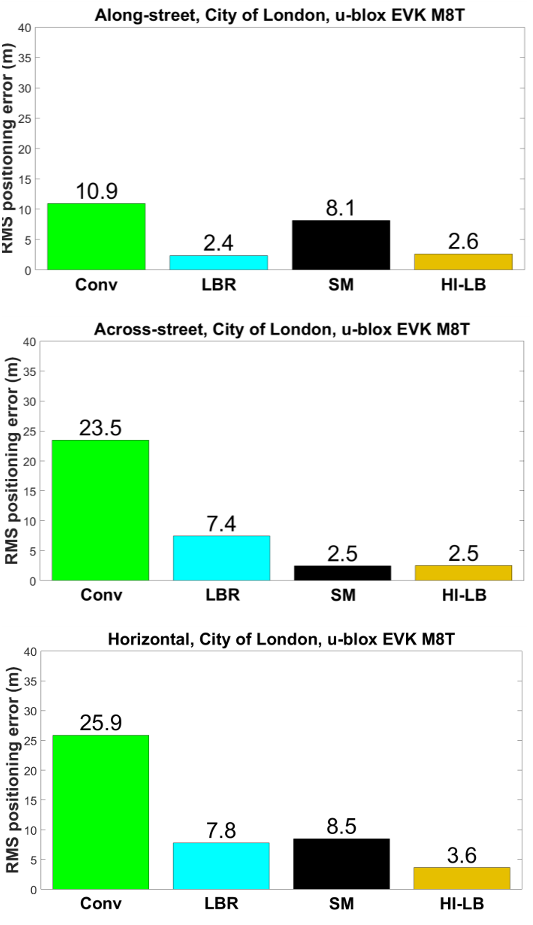
Figure 11. u-blox 2-constellation (GPS + GLONASS), City of London, along-street, across-street and horizontal RMS positioning error(Legend of Figure 10 applies for this figure) 
Figure 12. Across-street RMS positioning error of 2- and 3- constellation shadow matching 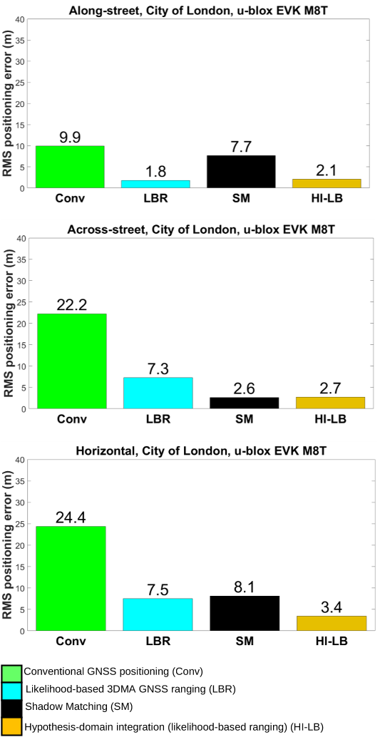
Figure 10. u-blox 3-constellation (GPS+GLONASS+Galileo), City of London, along-street, across-street and horizontal RMS positioning error 
TABLE II. DETAILS OF ACROSS-STREET 3-CONSTELLATION POSITIONING RESULTS USING U-BLOX EVK M8T GNSS RECEIVER 
TABLE I. DETAILS OF ALONG-STREET 3-CONSTELLATION POSITIONING RESULTS USING U-BLOX EVK M8T GNSS RECEIVER 
Figure 2: Proposed IUP algorithm 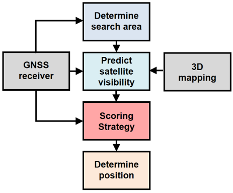
Figure 3: 3DMA GNSS approach 
Figure 5: Shadow matching scoring strategy 
Figure 6. u-blox EVK M8T-based data logging hardware


22 Jun 2017-