
All figures (11)
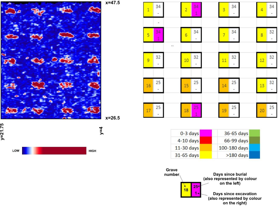
FIGURE 3: Depth slice image (0.6-0.7 m) for the 03 November 2014 survey; the schematic legend shows the period since initial burial (represented by colour of left half of grave blocks) and excavation (colour of right half of blocks) for corresponding graves. 
FIGURE 5: Depth slice and grave status information for the 03 December 2014 survey. 
FIGURE 10: Depth slice and grave status information for the 31 August 2015. 
TABLE 1: 3D GPR surveys conducted at the FABF site 
FIGURE 8: Depth slice and grave status information for the 31 March 2015 survey. 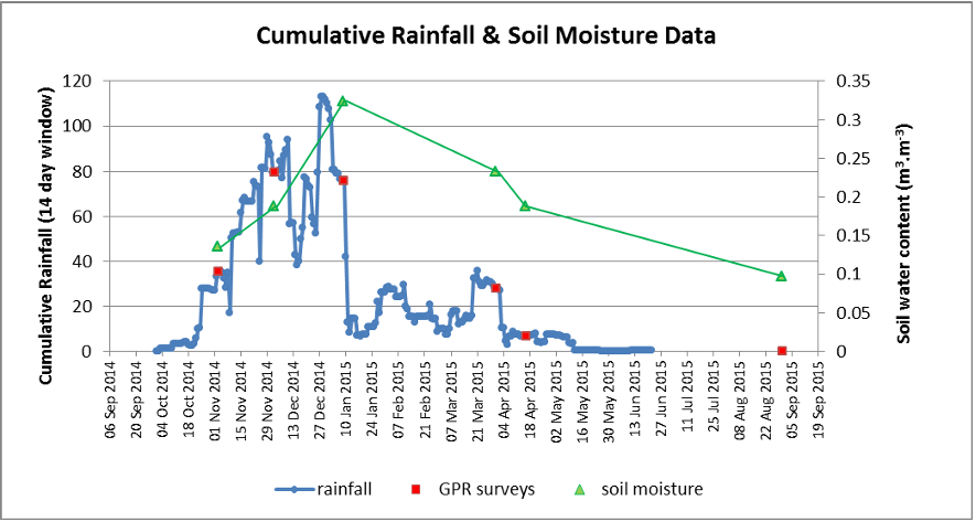
FIGURE 7: Cumulative rainfall (for a running 2-week window) and site-specific soil moisture data (derived from GPR velocity information). 
FIGURE 4: 2D profiles from the 03 November 2014 survey that transects the two scavenged and backfilled graves, numbers 2 and 5. 
FIGURE 2: Time-lapse GPR results for a selected 2D profile with a SE-NW orientation that crosses grave numbers 19, 14, 11, 7 and 3. 
FIGURE 9: Depth slice and grave status information for the 16 April 2015 survey. 
FIGURE 1: 3D GPR surveys conducted at the FABF site 
FIGURE 6: Depth slice and grave status information for the 09 January 2015 survey.


