Example of Remote Sensing of Environment format
Recent searches

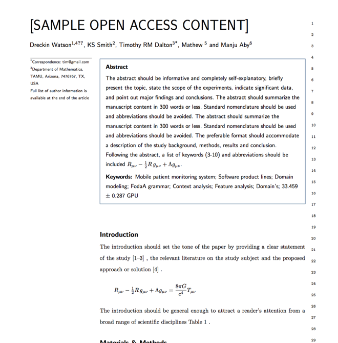
Example of Remote Sensing of Environment format Example of Remote Sensing of Environment format Example of Remote Sensing of Environment format Example of Remote Sensing of Environment format Example of Remote Sensing of Environment format Example of Remote Sensing of Environment format Example of Remote Sensing of Environment format
Sample paper formatted on SciSpace - SciSpace
This content is only for preview purposes. The original open access content can be found here.
Look Inside
Example of Remote Sensing of Environment format Example of Remote Sensing of Environment format Example of Remote Sensing of Environment format Example of Remote Sensing of Environment format Example of Remote Sensing of Environment format Example of Remote Sensing of Environment format Example of Remote Sensing of Environment format
Sample paper formatted on SciSpace - SciSpace
This content is only for preview purposes. The original open access content can be found here.
open access Open Access
recommended Recommended

Remote Sensing of Environment — Template for authors

Publisher: Elsevier
Categories Rank Trend in last 3 yrs
Geology #1 of 251 up up by 2 ranks
Soil Science #1 of 135 -
Computers in Earth Sciences #1 of 52 -
journal-quality-icon Journal quality:
High
calendar-icon Last 4 years overview: 1864 Published Papers | 32721 Citations
indexed-in-icon Indexed in: Scopus
last-updated-icon Last updated: 29/06/2020
Related journals
Insights
General info
Top papers
Popular templates
Get started guide
Why choose from SciSpace
FAQ

Related Journals

open access Open Access

Springer

Quality:  
High
CiteRatio: 4.5
SJR: 0.641
SNIP: 1.11
open access Open Access

Springer

Quality:  
High
CiteRatio: 2.3
SJR: 0.512
SNIP: 0.973
open access Open Access

Elsevier

Quality:  
Good
CiteRatio: 2.8
SJR: 0.518
SNIP: 0.73
open access Open Access

IEEE

Quality:  
High
CiteRatio: 7.2
SJR: 1.246
SNIP: 1.579

Journal Performance & Insights

CiteRatio

SCImago Journal Rank (SJR)

Source Normalized Impact per Paper (SNIP)

A measure of average citations received per peer-reviewed paper published in the journal.

Measures weighted citations received by the journal. Citation weighting depends on the categories and prestige of the citing journal.

Measures actual citations received relative to citations expected for the journal's category.

17.6

17% from 2019

CiteRatio for Remote Sensing of Environment from 2016 - 2020
Year Value
2020 17.6
2019 15.1
2018 13.1
2017 12.3
2016 10.7
graph view Graph view
table view Table view

3.611

2% from 2019

SJR for Remote Sensing of Environment from 2016 - 2020
Year Value
2020 3.611
2019 3.541
2018 3.208
2017 3.121
2016 3.035
graph view Graph view
table view Table view

3.345

4% from 2019

SNIP for Remote Sensing of Environment from 2016 - 2020
Year Value
2020 3.345
2019 3.225
2018 3.291
2017 2.628
2016 3.002
graph view Graph view
table view Table view

insights Insights

  • CiteRatio of this journal has increased by 17% in last years.
  • This journal’s CiteRatio is in the top 10 percentile category.

insights Insights

  • SJR of this journal has increased by 2% in last years.
  • This journal’s SJR is in the top 10 percentile category.

insights Insights

  • SNIP of this journal has increased by 4% in last years.
  • This journal’s SNIP is in the top 10 percentile category.

Remote Sensing of Environment

Guideline source: View

All company, product and service names used in this website are for identification purposes only. All product names, trademarks and registered trademarks are property of their respective owners.

Use of these names, trademarks and brands does not imply endorsement or affiliation. Disclaimer Notice

Elsevier

Remote Sensing of Environment

Remote Sensing of Environment serves the remote sensing community with the publication of results on theory, science, applications and technology of remote sensing of Earth resources and environment. Thoroughly interdisciplinary, this journal publishes on terrestrial, oceanic,...... Read More

Geology

Soil Science

Computers in Earth Sciences

Earth and Planetary Sciences

i
Last updated on
29 Jun 2020
i
ISSN
0034-4257
i
Impact Factor
High - 2.904
i
Open Access
No
i
Sherpa RoMEO Archiving Policy
Green faq
i
Plagiarism Check
Available via Turnitin
i
Endnote Style
Download Available
i
Bibliography Name
elsarticle-num
i
Citation Type
Numbered
[25]
i
Bibliography Example
G. E. Blonder, M. Tinkham, T. M. Klapwijk, Transition from metallic to tunneling regimes in superconducting microconstrictions: Excess current, charge imbalance, and supercurrent conversion, Phys. Rev. B 25 (7) (1982) 4515–4532. URL 10.1103/PhysRevB.25.4515

Top papers written in this journal

open accessOpen access Journal Article DOI: 10.1016/0034-4257(79)90013-0
Red and photographic infrared linear combinations for monitoring vegetation
Compton J. Tucker1

Abstract:

The relationships between various linear combinations of red and photographic infrared radiances and vegetation parameters are investigated. In situ spectrometers are used to measure the relationships between linear combinations of red and IR radiances, their ratios and square roots, and biomass, leaf water content and chloro... The relationships between various linear combinations of red and photographic infrared radiances and vegetation parameters are investigated. In situ spectrometers are used to measure the relationships between linear combinations of red and IR radiances, their ratios and square roots, and biomass, leaf water content and chlorophyll content of a grass canopy in June, September and October. Regression analysis shows red-IR combinations to be more significant than green-red combinations. The IR/red ratio, the square root of the IR/red ratio, the vegetation index (IR-red difference divided by their sum) and the transformed vegetation index (the square root of the vegetation index + 0.5) are found to be sensitive to the amount of photosynthetically active vegetation. The accumulation of dead vegetation over the year is found to have a linearizing effect on the various vegetation measures. read more read less

Topics:

Enhanced vegetation index (69%)69% related to the paper, Red edge (63%)63% related to the paper, Vegetation (pathology) (62%)62% related to the paper, Normalized Difference Vegetation Index (61%)61% related to the paper, Photochemical Reflectance Index (54%)54% related to the paper
View PDF
7,225 Citations
Journal Article DOI: 10.1016/0034-4257(91)90048-B
A review of assessing the accuracy of classifications of remotely sensed data
Russell G. Congalton1

Abstract:

This paper reviews the necessary considerations and available techniques for assessing the accuracy of remotely sensed data. Included in this review are the classification system, the sampling scheme, the sample size, spatial autocorrelation, and the assessment techniques. All analysis is based on the use of an error matrix o... This paper reviews the necessary considerations and available techniques for assessing the accuracy of remotely sensed data. Included in this review are the classification system, the sampling scheme, the sample size, spatial autocorrelation, and the assessment techniques. All analysis is based on the use of an error matrix or contingency table. Example matrices and results of the analysis are presented. Future trends including the need for assessment of other spatial data are also discussed. read more read less

Topics:

Spatial analysis (53%)53% related to the paper
6,075 Citations
Journal Article DOI: 10.1016/S0034-4257(98)00031-5
AERONET-a federated instrument network and data archive for aerosol Characterization

Abstract:

The concept and description of a remote sensing aerosol monitoring network initiated by NASA, developed to support NASA, CNES, and NASDA’s Earth satellite systems under the name AERONET and expanded by national and international collaboration, is described. Recent development of weather-resistant automatic sun and sky scannin... The concept and description of a remote sensing aerosol monitoring network initiated by NASA, developed to support NASA, CNES, and NASDA’s Earth satellite systems under the name AERONET and expanded by national and international collaboration, is described. Recent development of weather-resistant automatic sun and sky scanning spectral radiometers enable frequent measurements of atmospheric aerosol optical properties and precipitable water at remote sites. Transmission of automatic measurements via the geostationary satellites GOES and METEOSATS’ Data Collection Systems allows reception and processing in near real-time from approximately 75% of the Earth’s surface and with the expected addition of GMS, the coverage will increase to 90% in 1998. NASA developed a UNIX-based near real-time processing, display and analysis system providing internet access to the emerging global database. Information on the system is available on the project homepage, http://spamer.gsfc.nasa.gov . The philosophy of an open access database, centralized processing and a user-friendly graphical interface has contributed to the growth of international cooperation for ground-based aerosol monitoring and imposes a standardization for these measurements. The system’s automatic data acquisition, transmission, and processing facilitates aerosol characterization on local, regional, and global scales with applications to transport and radiation budget studies, radiative transfer-modeling and validation of satellite aerosol retrievals. This article discusses the operation and philosophy of the monitoring system, the precision and accuracy of the measuring radiometers, a brief description of the processing system, and access to the database. read more read less

Topics:

AERONET (59%)59% related to the paper, Multi-angle Imaging SpectroRadiometer (54%)54% related to the paper, Angstrom exponent (53%)53% related to the paper, Geostationary orbit (50%)50% related to the paper
View PDF
5,936 Citations
Journal Article DOI: 10.1016/S0034-4257(02)00096-2
Overview of the radiometric and biophysical performance of the MODIS vegetation indices
Alfredo Huete1, Kamel Didan1, Tomoaki Miura1, E.P. Rodriguez1, Xiang Gao1, Laerte Guimarães Ferreira2

Abstract:

We evaluated the initial 12 months of vegetation index product availability from the Moderate Resolution Imaging Spectroradiometer (MODIS) on board the Earth Observing System-Terra platform. Two MODIS vegetation indices (VI), the normalized difference vegetation index (NDVI) and enhanced vegetation index (EVI), are produced a... We evaluated the initial 12 months of vegetation index product availability from the Moderate Resolution Imaging Spectroradiometer (MODIS) on board the Earth Observing System-Terra platform. Two MODIS vegetation indices (VI), the normalized difference vegetation index (NDVI) and enhanced vegetation index (EVI), are produced at 1-km and 500-m resolutions and 16-day compositing periods. This paper presents an initial analysis of the MODIS NDVI and EVI performance from both radiometric and biophysical perspectives. We utilize a combination of site-intensive and regionally extensive approaches to demonstrate the performance and validity of the two indices. Our results showed a good correspondence between airborne-measured, top-of-canopy reflectances and VI values with those from the MODIS sensor at four intensively measured test sites representing semi-arid grass/shrub, savanna, and tropical forest biomes. Simultaneously derived field biophysical measures also demonstrated the scientific utility of the MODIS VI. Multitemporal profiles of the MODIS VIs over numerous biome types in North and South America well represented their seasonal phenologies. Comparisons of the MODIS-NDVI with the NOAA-14, 1-km AVHRR-NDVI temporal profiles showed that the MODIS-based index performed with higher fidelity. The dynamic range of the MODIS VIs are presented and their sensitivities in discriminating vegetation differences are evaluated in sparse and dense vegetation areas. We found the NDVI to asymptotically saturate in high biomass regions such as in the Amazon while the EVI remained sensitive to canopy variations. read more read less

Topics:

Enhanced vegetation index (71%)71% related to the paper, Normalized Difference Vegetation Index (60%)60% related to the paper, Moderate-resolution imaging spectroradiometer (58%)58% related to the paper, Vegetation (pathology) (54%)54% related to the paper
View PDF
5,802 Citations
Journal Article DOI: 10.1016/0034-4257(88)90106-X
A soil-adjusted vegetation index (SAVI)
Alfredo Huete1

Abstract:

A transformation technique is presented to minimize soil brightness influences from spectral vegetation indices involving red and near-infrared (NIR) wavelengths. Graphically, the transformation involves a shifting of the origin of reflectance spectra plotted in NIR-red wavelength space to account for first-order soil-vegetat... A transformation technique is presented to minimize soil brightness influences from spectral vegetation indices involving red and near-infrared (NIR) wavelengths. Graphically, the transformation involves a shifting of the origin of reflectance spectra plotted in NIR-red wavelength space to account for first-order soil-vegetation interactions and differential red and NIR flux extinction through vegetated canopies. For cotton (Gossypium hirsutum L. var DPI-70) and range grass (Eragrosticslehmanniana Nees) canopies, underlain with different soil backgrounds, the transformation nearly eliminated soil-induced variations in vegetation indices. A physical basis for the soil-adjusted vegetation index (SAVI) is subsequently presented. The SAVI was found to be an important step toward the establishment of simple °lobal” that can describe dynamic soil-vegetation systems from remotely sensed data. read more read less

Topics:

Enhanced vegetation index (60%)60% related to the paper, Vegetation (pathology) (54%)54% related to the paper
4,653 Citations
Author Pic

SciSpace is a very innovative solution to the formatting problem and existing providers, such as Mendeley or Word did not really evolve in recent years.

- Andreas Frutiger, Researcher, ETH Zurich, Institute for Biomedical Engineering

Get MS-Word and LaTeX output to any Journal within seconds
1
Choose a template
Select a template from a library of 40,000+ templates
2
Import a MS-Word file or start fresh
It takes only few seconds to import
3
View and edit your final output
SciSpace will automatically format your output to meet journal guidelines
4
Submit directly or Download
Submit to journal directly or Download in PDF, MS Word or LaTeX

(Before submission check for plagiarism via Turnitin)

clock Less than 3 minutes

What to expect from SciSpace?

Speed and accuracy over MS Word

''

With SciSpace, you do not need a word template for Remote Sensing of Environment.

It automatically formats your research paper to Elsevier formatting guidelines and citation style.

You can download a submission ready research paper in pdf, LaTeX and docx formats.

Time comparison

Time taken to format a paper and Compliance with guidelines

Plagiarism Reports via Turnitin

SciSpace has partnered with Turnitin, the leading provider of Plagiarism Check software.

Using this service, researchers can compare submissions against more than 170 million scholarly articles, a database of 70+ billion current and archived web pages. How Turnitin Integration works?


Turnitin Stats
Publisher Logos

Freedom from formatting guidelines

One editor, 100K journal formats – world's largest collection of journal templates

With such a huge verified library, what you need is already there.

publisher-logos

Easy support from all your favorite tools

Remote Sensing of Environment format uses elsarticle-num citation style.

Automatically format and order your citations and bibliography in a click.

SciSpace allows imports from all reference managers like Mendeley, Zotero, Endnote, Google Scholar etc.

Frequently asked questions

1. Can I write Remote Sensing of Environment in LaTeX?

Absolutely not! Our tool has been designed to help you focus on writing. You can write your entire paper as per the Remote Sensing of Environment guidelines and auto format it.

2. Do you follow the Remote Sensing of Environment guidelines?

Yes, the template is compliant with the Remote Sensing of Environment guidelines. Our experts at SciSpace ensure that. If there are any changes to the journal's guidelines, we'll change our algorithm accordingly.

3. Can I cite my article in multiple styles in Remote Sensing of Environment?

Of course! We support all the top citation styles, such as APA style, MLA style, Vancouver style, Harvard style, and Chicago style. For example, when you write your paper and hit autoformat, our system will automatically update your article as per the Remote Sensing of Environment citation style.

4. Can I use the Remote Sensing of Environment templates for free?

Sign up for our free trial, and you'll be able to use all our features for seven days. You'll see how helpful they are and how inexpensive they are compared to other options, Especially for Remote Sensing of Environment.

5. Can I use a manuscript in Remote Sensing of Environment that I have written in MS Word?

Yes. You can choose the right template, copy-paste the contents from the word document, and click on auto-format. Once you're done, you'll have a publish-ready paper Remote Sensing of Environment that you can download at the end.

6. How long does it usually take you to format my papers in Remote Sensing of Environment?

It only takes a matter of seconds to edit your manuscript. Besides that, our intuitive editor saves you from writing and formatting it in Remote Sensing of Environment.

7. Where can I find the template for the Remote Sensing of Environment?

It is possible to find the Word template for any journal on Google. However, why use a template when you can write your entire manuscript on SciSpace , auto format it as per Remote Sensing of Environment's guidelines and download the same in Word, PDF and LaTeX formats? Give us a try!.

8. Can I reformat my paper to fit the Remote Sensing of Environment's guidelines?

Of course! You can do this using our intuitive editor. It's very easy. If you need help, our support team is always ready to assist you.

9. Remote Sensing of Environment an online tool or is there a desktop version?

SciSpace's Remote Sensing of Environment is currently available as an online tool. We're developing a desktop version, too. You can request (or upvote) any features that you think would be helpful for you and other researchers in the "feature request" section of your account once you've signed up with us.

10. I cannot find my template in your gallery. Can you create it for me like Remote Sensing of Environment?

Sure. You can request any template and we'll have it setup within a few days. You can find the request box in Journal Gallery on the right side bar under the heading, "Couldn't find the format you were looking for like Remote Sensing of Environment?”

11. What is the output that I would get after using Remote Sensing of Environment?

After writing your paper autoformatting in Remote Sensing of Environment, you can download it in multiple formats, viz., PDF, Docx, and LaTeX.

12. Is Remote Sensing of Environment's impact factor high enough that I should try publishing my article there?

To be honest, the answer is no. The impact factor is one of the many elements that determine the quality of a journal. Few of these factors include review board, rejection rates, frequency of inclusion in indexes, and Eigenfactor. You need to assess all these factors before you make your final call.

13. What is Sherpa RoMEO Archiving Policy for Remote Sensing of Environment?

SHERPA/RoMEO Database

We extracted this data from Sherpa Romeo to help researchers understand the access level of this journal in accordance with the Sherpa Romeo Archiving Policy for Remote Sensing of Environment. The table below indicates the level of access a journal has as per Sherpa Romeo's archiving policy.

RoMEO Colour Archiving policy
Green Can archive pre-print and post-print or publisher's version/PDF
Blue Can archive post-print (ie final draft post-refereeing) or publisher's version/PDF
Yellow Can archive pre-print (ie pre-refereeing)
White Archiving not formally supported
FYI:
  1. Pre-prints as being the version of the paper before peer review and
  2. Post-prints as being the version of the paper after peer-review, with revisions having been made.

14. What are the most common citation types In Remote Sensing of Environment?

The 5 most common citation types in order of usage for Remote Sensing of Environment are:.

S. No. Citation Style Type
1. Author Year
2. Numbered
3. Numbered (Superscripted)
4. Author Year (Cited Pages)
5. Footnote

15. How do I submit my article to the Remote Sensing of Environment?

It is possible to find the Word template for any journal on Google. However, why use a template when you can write your entire manuscript on SciSpace , auto format it as per Remote Sensing of Environment's guidelines and download the same in Word, PDF and LaTeX formats? Give us a try!.

16. Can I download Remote Sensing of Environment in Endnote format?

Yes, SciSpace provides this functionality. After signing up, you would need to import your existing references from Word or Bib file to SciSpace. Then SciSpace would allow you to download your references in Remote Sensing of Environment Endnote style according to Elsevier guidelines.

Fast and reliable,
built for complaince.

Instant formatting to 100% publisher guidelines on - SciSpace.

Available only on desktops 🖥

No word template required

Typset automatically formats your research paper to Remote Sensing of Environment formatting guidelines and citation style.

Verifed journal formats

One editor, 100K journal formats.
With the largest collection of verified journal formats, what you need is already there.

Trusted by academicians

I spent hours with MS word for reformatting. It was frustrating - plain and simple. With SciSpace, I can draft my manuscripts and once it is finished I can just submit. In case, I have to submit to another journal it is really just a button click instead of an afternoon of reformatting.

Andreas Frutiger
Researcher & Ex MS Word user
Use this template