Example of Journal of Hydrometeorology format
Recent searches

Example of Journal of Hydrometeorology format Example of Journal of Hydrometeorology format Example of Journal of Hydrometeorology format Example of Journal of Hydrometeorology format Example of Journal of Hydrometeorology format Example of Journal of Hydrometeorology format Example of Journal of Hydrometeorology format Example of Journal of Hydrometeorology format Example of Journal of Hydrometeorology format Example of Journal of Hydrometeorology format Example of Journal of Hydrometeorology format Example of Journal of Hydrometeorology format Example of Journal of Hydrometeorology format Example of Journal of Hydrometeorology format Example of Journal of Hydrometeorology format Example of Journal of Hydrometeorology format Example of Journal of Hydrometeorology format Example of Journal of Hydrometeorology format Example of Journal of Hydrometeorology format Example of Journal of Hydrometeorology format Example of Journal of Hydrometeorology format Example of Journal of Hydrometeorology format Example of Journal of Hydrometeorology format Example of Journal of Hydrometeorology format Example of Journal of Hydrometeorology format Example of Journal of Hydrometeorology format Example of Journal of Hydrometeorology format Example of Journal of Hydrometeorology format Example of Journal of Hydrometeorology format Example of Journal of Hydrometeorology format
Sample paper formatted on SciSpace - SciSpace
This content is only for preview purposes. The original open access content can be found here.
Look Inside
Example of Journal of Hydrometeorology format Example of Journal of Hydrometeorology format Example of Journal of Hydrometeorology format Example of Journal of Hydrometeorology format Example of Journal of Hydrometeorology format Example of Journal of Hydrometeorology format Example of Journal of Hydrometeorology format Example of Journal of Hydrometeorology format Example of Journal of Hydrometeorology format Example of Journal of Hydrometeorology format Example of Journal of Hydrometeorology format Example of Journal of Hydrometeorology format Example of Journal of Hydrometeorology format Example of Journal of Hydrometeorology format Example of Journal of Hydrometeorology format Example of Journal of Hydrometeorology format Example of Journal of Hydrometeorology format Example of Journal of Hydrometeorology format Example of Journal of Hydrometeorology format Example of Journal of Hydrometeorology format Example of Journal of Hydrometeorology format Example of Journal of Hydrometeorology format Example of Journal of Hydrometeorology format Example of Journal of Hydrometeorology format Example of Journal of Hydrometeorology format Example of Journal of Hydrometeorology format Example of Journal of Hydrometeorology format Example of Journal of Hydrometeorology format Example of Journal of Hydrometeorology format Example of Journal of Hydrometeorology format
Sample paper formatted on SciSpace - SciSpace
This content is only for preview purposes. The original open access content can be found here.
open access Open Access

Journal of Hydrometeorology — Template for authors

Categories Rank Trend in last 3 yrs
Atmospheric Science #22 of 124 down down by 7 ranks
journal-quality-icon Journal quality:
High
calendar-icon Last 4 years overview: 584 Published Papers | 4010 Citations
indexed-in-icon Indexed in: Scopus
last-updated-icon Last updated: 18/07/2020
Related journals
Insights
General info
Top papers
Popular templates
Get started guide
Why choose from SciSpace
FAQ

Related Journals

open access Open Access

IEEE

Quality:  
High
CiteRatio: 7.2
SJR: 1.246
SNIP: 1.579
open access Open Access
recommended Recommended

American Meteorological Society

Quality:  
High
CiteRatio: 13.5
SJR: 3.367
SNIP: 2.93
open access Open Access

American Meteorological Society

Quality:  
High
CiteRatio: 4.1
SJR: 0.774
SNIP: 1.154
open access Open Access
recommended Recommended

American Meteorological Society

Quality:  
High
CiteRatio: 9.8
SJR: 3.315
SNIP: 1.909

Journal Performance & Insights

Impact Factor

CiteRatio

Determines the importance of a journal by taking a measure of frequency with which the average article in a journal has been cited in a particular year.

A measure of average citations received per peer-reviewed paper published in the journal.

3.891

6% from 2018

Impact factor for Journal of Hydrometeorology from 2016 - 2019
Year Value
2019 3.891
2018 4.158
2017 3.79
2016 3.641
graph view Graph view
table view Table view

6.9

13% from 2019

CiteRatio for Journal of Hydrometeorology from 2016 - 2020
Year Value
2020 6.9
2019 7.9
2018 7.6
2017 6.3
2016 6.0
graph view Graph view
table view Table view

insights Insights

  • Impact factor of this journal has decreased by 6% in last year.
  • This journal’s impact factor is in the top 10 percentile category.

insights Insights

  • CiteRatio of this journal has decreased by 13% in last years.
  • This journal’s CiteRatio is in the top 10 percentile category.

SCImago Journal Rank (SJR)

Source Normalized Impact per Paper (SNIP)

Measures weighted citations received by the journal. Citation weighting depends on the categories and prestige of the citing journal.

Measures actual citations received relative to citations expected for the journal's category.

1.733

18% from 2019

SJR for Journal of Hydrometeorology from 2016 - 2020
Year Value
2020 1.733
2019 2.101
2018 2.413
2017 2.243
2016 2.23
graph view Graph view
table view Table view

1.328

0% from 2019

SNIP for Journal of Hydrometeorology from 2016 - 2020
Year Value
2020 1.328
2019 1.332
2018 1.355
2017 1.309
2016 1.39
graph view Graph view
table view Table view

insights Insights

  • SJR of this journal has decreased by 18% in last years.
  • This journal’s SJR is in the top 10 percentile category.

insights Insights

  • SNIP of this journal has decreased by 0% in last years.
  • This journal’s SNIP is in the top 10 percentile category.

Journal of Hydrometeorology

Guideline source: View

All company, product and service names used in this website are for identification purposes only. All product names, trademarks and registered trademarks are property of their respective owners.

Use of these names, trademarks and brands does not imply endorsement or affiliation. Disclaimer Notice

American Meteorological Society

Journal of Hydrometeorology

Research related to the modeling, observing, and forecasting of processes related to water and energy fluxes and storage terms, including interactions with the boundary layer and lower atmosphere, and including processes related to precipitation, radiation, and other meteorolo...... Read More

Atmospheric Science

Earth and Planetary Sciences

i
Last updated on
18 Jul 2020
i
ISSN
1525-755X
i
Impact Factor
High - 1.347
i
Acceptance Rate
Not provided
i
Frequency
Not provided
i
Open Access
No
i
Sherpa RoMEO Archiving Policy
Yellow faq
i
Plagiarism Check
Available via Turnitin
i
Endnote Style
Download Available
i
Bibliography Name
numbered
i
Citation Type
Author Year
(Blonder et al. 1982)
i
Bibliography Example
Blonder, G. E., M. Tinkham, and T. M. Klapwijk, 1982: Transition from metallic to tunneling regimes in superconducting microconstrictions: Excess current, charge imbalance, and supercurrent conversion. Phys. Rev. B, 25 (7), 4515–4532, URL 10.1103/PhysRevB.25.4515.

Top papers written in this journal

open accessOpen access Journal Article DOI: 10.1175/JHM560.1
The TRMM Multisatellite Precipitation Analysis (TMPA): Quasi-Global, Multiyear, Combined-Sensor Precipitation Estimates at Fine Scales

Abstract:

The Tropical Rainfall Measuring Mission (TRMM) Multisatellite Precipitation Analysis (TMPA) provides a calibration-based sequential scheme for combining precipitation estimates from multiple satellites, as well as gauge analyses where feasible, at fine scales (0.25° × 0.25° and 3 hourly). TMPA is available both after and in r... The Tropical Rainfall Measuring Mission (TRMM) Multisatellite Precipitation Analysis (TMPA) provides a calibration-based sequential scheme for combining precipitation estimates from multiple satellites, as well as gauge analyses where feasible, at fine scales (0.25° × 0.25° and 3 hourly). TMPA is available both after and in real time, based on calibration by the TRMM Combined Instrument and TRMM Microwave Imager precipitation products, respectively. Only the after-real-time product incorporates gauge data at the present. The dataset covers the latitude band 50°N–S for the period from 1998 to the delayed present. Early validation results are as follows: the TMPA provides reasonable performance at monthly scales, although it is shown to have precipitation rate–dependent low bias due to lack of sensitivity to low precipitation rates over ocean in one of the input products [based on Advanced Microwave Sounding Unit-B (AMSU-B)]. At finer scales the TMPA is successful at approximately reproducing the s... read more read less

Topics:

PERSIANN (59%)59% related to the paper, Quantitative precipitation estimation (59%)59% related to the paper, Global Precipitation Measurement (57%)57% related to the paper, Advanced Microwave Sounding Unit (51%)51% related to the paper
View PDF
6,179 Citations
open accessOpen access Journal Article DOI: 10.1175/1525-7541(2003)004<1147:TVGPCP>2.0.CO;2
The Version 2 Global Precipitation Climatology Project (GPCP) Monthly Precipitation Analysis (1979-Present)

Abstract:

The Global Precipitation Climatology Project (GPCP) Version 2 Monthly Precipitation Analysis is described. This globally complete, monthly analysis of surface precipitation at 2.5 degrees x 2.5 degrees latitude-longitude resolution is available from January 1979 to the present. It is a merged analysis that incorporates precip... The Global Precipitation Climatology Project (GPCP) Version 2 Monthly Precipitation Analysis is described. This globally complete, monthly analysis of surface precipitation at 2.5 degrees x 2.5 degrees latitude-longitude resolution is available from January 1979 to the present. It is a merged analysis that incorporates precipitation estimates from low-orbit-satellite microwave data, geosynchronous-orbit-satellite infrared data, and rain gauge observations. The merging approach utilizes the higher accuracy of the low-orbit microwave observations to calibrate, or adjust, the more frequent geosynchronous infrared observations. The data set is extended back into the premicrowave era (before 1987) by using infrared-only observations calibrated to the microwave-based analysis of the later years. The combined satellite-based product is adjusted by the raingauge analysis. This monthly analysis is the foundation for the GPCP suite of products including those at finer temporal resolution, satellite estimate, and error estimates for each field. The 23-year GPCP climatology is characterized, along with time and space variations of precipitation. read more read less

Topics:

PERSIANN (64%)64% related to the paper, Quantitative precipitation estimation (63%)63% related to the paper, Rain gauge (51%)51% related to the paper
View PDF
4,951 Citations
CMORPH: A Method that Produces Global Precipitation Estimates from Passive Microwave and Infrared Data at High Spatial and Temporal Resolution
Robert Joyce1, John E. Janowiak1, Phillip A. Arkin2, Pingping Xie1

Abstract:

A new technique is presented in which half-hourly global precipitation estimates derived from passive microwave satellite scans are propagated by motion vectors derived from geostationary satellite infrared data. The Climate Prediction Center morphing method (CMORPH) uses motion vectors derived from half-hourly interval geost... A new technique is presented in which half-hourly global precipitation estimates derived from passive microwave satellite scans are propagated by motion vectors derived from geostationary satellite infrared data. The Climate Prediction Center morphing method (CMORPH) uses motion vectors derived from half-hourly interval geostationary satellite IR imagery to propagate the relatively high quality precipitation estimates derived from passive microwave data. In addition, the shape and intensity of the precipitation features are modified (morphed) during the time between microwave sensor scans by performing a time-weighted linear interpolation. This process yields spatially and temporally complete microwave-derived precipitation analyses, independent of the infrared temperature field. CMORPH showed substantial improvements over both simple averaging of the microwave estimates and over techniques that blend microwave and infrared information but that derive estimates of precipitation from infrared data... read more read less

Topics:

PERSIANN (62%)62% related to the paper, Quantitative precipitation estimation (60%)60% related to the paper, Global Precipitation Measurement (57%)57% related to the paper, Microwave (51%)51% related to the paper
2,784 Citations
open accessOpen access Journal Article DOI: 10.1175/JHM-386.1
A Global Dataset of Palmer Drought Severity Index for 1870–2002: Relationship with Soil Moisture and Effects of Surface Warming
Aiguo Dai1, K Evin E. Trenberth1, Taotao Qian1

Abstract:

A monthly dataset of Palmer Drought Severity Index (PDSI) from 1870 to 2002 is derived using historical precipitation and temperature data for global land areas on a 2.58 grid. Over Illinois, Mongolia, and parts of China and the former Soviet Union, where soil moisture data are available, the PDSI is significantly correlated ... A monthly dataset of Palmer Drought Severity Index (PDSI) from 1870 to 2002 is derived using historical precipitation and temperature data for global land areas on a 2.58 grid. Over Illinois, Mongolia, and parts of China and the former Soviet Union, where soil moisture data are available, the PDSI is significantly correlated (r 5 0.5 to 0.7) with observed soil moisture content within the top 1-m depth during warm-season months. The strongest correlation is in late summer and autumn, and the weakest correlation is in spring, when snowmelt plays an important role. Basin-averaged annual PDSI covary closely (r 5 0.6 to 0.8) with streamflow for seven of world’s largest rivers and several smaller rivers examined. The results suggest that the PDSI is a good proxy of both surface moisture conditions and streamflow. An empirical orthogonal function (EOF) analysis of the P ← ] read more read less
View PDF
1,917 Citations
open accessOpen access Journal Article DOI: 10.1175/1525-7541(2001)002<0036:GPAODD>2.0.CO;2
Global Precipitation at One-Degree Daily Resolution from Multisatellite Observations

Abstract:

The One-Degree Daily (1DD) technique is described for producing globally complete daily estimates of precipitation on a 1 deg x 1 deg lat/long grid from currently available observational data. Where possible (40 deg N-40 deg S), the Threshold-Matched Precipitation Index (TMPI) provides precipitation estimates in which the 3-h... The One-Degree Daily (1DD) technique is described for producing globally complete daily estimates of precipitation on a 1 deg x 1 deg lat/long grid from currently available observational data. Where possible (40 deg N-40 deg S), the Threshold-Matched Precipitation Index (TMPI) provides precipitation estimates in which the 3-hourly infrared brightness temperatures (IR T(sub b)) are thresholded and all "cold" pixels are given a single precipitation rate. This approach is an adaptation of the Geostationary Operational Environmental Satellite (GOES) Precipitation Index (GPI), but for the TMPI the IR Tb threshold and conditional rain rate are set locally by month from Special Sensor Microwave/Imager (SSM/I)-based precipitation frequency and the Global Precipitation Climatology Project (GPCP) satellite-gauge (SG) combined monthly precipitation estimate, respectively. At higher latitudes the 1DD features a rescaled daily Television Infrared Observation Satellite (TIROS) Operational Vertical Sounder (TOVS) precipitation. The frequency of rain days in the TOVS is scaled down to match that in the TMPI at the data boundaries, and the resulting non-zero TOVS values are scaled locally to sum to the SG (which is a globally complete monthly product). The time series of the daily 1DD global images shows good continuity in time and across the data boundaries. Various examples are shown to illustrate uses. Validation for individual grid -box values shows a very high root-mean-square error but, it improves quickly when users perform time/space averaging according to their own requirements. read more read less

Topics:

PERSIANN (61%)61% related to the paper, Quantitative precipitation forecast (57%)57% related to the paper, Precipitation (51%)51% related to the paper
View PDF
1,752 Citations
Author Pic

SciSpace is a very innovative solution to the formatting problem and existing providers, such as Mendeley or Word did not really evolve in recent years.

- Andreas Frutiger, Researcher, ETH Zurich, Institute for Biomedical Engineering

Get MS-Word and LaTeX output to any Journal within seconds
1
Choose a template
Select a template from a library of 40,000+ templates
2
Import a MS-Word file or start fresh
It takes only few seconds to import
3
View and edit your final output
SciSpace will automatically format your output to meet journal guidelines
4
Submit directly or Download
Submit to journal directly or Download in PDF, MS Word or LaTeX

(Before submission check for plagiarism via Turnitin)

clock Less than 3 minutes

What to expect from SciSpace?

Speed and accuracy over MS Word

''

With SciSpace, you do not need a word template for Journal of Hydrometeorology.

It automatically formats your research paper to American Meteorological Society formatting guidelines and citation style.

You can download a submission ready research paper in pdf, LaTeX and docx formats.

Time comparison

Time taken to format a paper and Compliance with guidelines

Plagiarism Reports via Turnitin

SciSpace has partnered with Turnitin, the leading provider of Plagiarism Check software.

Using this service, researchers can compare submissions against more than 170 million scholarly articles, a database of 70+ billion current and archived web pages. How Turnitin Integration works?

Turnitin Stats
Publisher Logos

Freedom from formatting guidelines

One editor, 100K journal formats – world's largest collection of journal templates

With such a huge verified library, what you need is already there.

publisher-logos

Easy support from all your favorite tools

Journal of Hydrometeorology format uses numbered citation style.

Automatically format and order your citations and bibliography in a click.

SciSpace allows imports from all reference managers like Mendeley, Zotero, Endnote, Google Scholar etc.

Frequently asked questions

1. Can I write Journal of Hydrometeorology in LaTeX?

Absolutely not! Our tool has been designed to help you focus on writing. You can write your entire paper as per the Journal of Hydrometeorology guidelines and auto format it.

2. Do you follow the Journal of Hydrometeorology guidelines?

Yes, the template is compliant with the Journal of Hydrometeorology guidelines. Our experts at SciSpace ensure that. If there are any changes to the journal's guidelines, we'll change our algorithm accordingly.

3. Can I cite my article in multiple styles in Journal of Hydrometeorology?

Of course! We support all the top citation styles, such as APA style, MLA style, Vancouver style, Harvard style, and Chicago style. For example, when you write your paper and hit autoformat, our system will automatically update your article as per the Journal of Hydrometeorology citation style.

4. Can I use the Journal of Hydrometeorology templates for free?

Sign up for our free trial, and you'll be able to use all our features for seven days. You'll see how helpful they are and how inexpensive they are compared to other options, Especially for Journal of Hydrometeorology.

5. Can I use a manuscript in Journal of Hydrometeorology that I have written in MS Word?

Yes. You can choose the right template, copy-paste the contents from the word document, and click on auto-format. Once you're done, you'll have a publish-ready paper Journal of Hydrometeorology that you can download at the end.

6. How long does it usually take you to format my papers in Journal of Hydrometeorology?

It only takes a matter of seconds to edit your manuscript. Besides that, our intuitive editor saves you from writing and formatting it in Journal of Hydrometeorology.

7. Where can I find the template for the Journal of Hydrometeorology?

It is possible to find the Word template for any journal on Google. However, why use a template when you can write your entire manuscript on SciSpace , auto format it as per Journal of Hydrometeorology's guidelines and download the same in Word, PDF and LaTeX formats? Give us a try!.

8. Can I reformat my paper to fit the Journal of Hydrometeorology's guidelines?

Of course! You can do this using our intuitive editor. It's very easy. If you need help, our support team is always ready to assist you.

9. Journal of Hydrometeorology an online tool or is there a desktop version?

SciSpace's Journal of Hydrometeorology is currently available as an online tool. We're developing a desktop version, too. You can request (or upvote) any features that you think would be helpful for you and other researchers in the "feature request" section of your account once you've signed up with us.

10. I cannot find my template in your gallery. Can you create it for me like Journal of Hydrometeorology?

Sure. You can request any template and we'll have it setup within a few days. You can find the request box in Journal Gallery on the right side bar under the heading, "Couldn't find the format you were looking for like Journal of Hydrometeorology?”

11. What is the output that I would get after using Journal of Hydrometeorology?

After writing your paper autoformatting in Journal of Hydrometeorology, you can download it in multiple formats, viz., PDF, Docx, and LaTeX.

12. Is Journal of Hydrometeorology's impact factor high enough that I should try publishing my article there?

To be honest, the answer is no. The impact factor is one of the many elements that determine the quality of a journal. Few of these factors include review board, rejection rates, frequency of inclusion in indexes, and Eigenfactor. You need to assess all these factors before you make your final call.

13. What is Sherpa RoMEO Archiving Policy for Journal of Hydrometeorology?

SHERPA/RoMEO Database

We extracted this data from Sherpa Romeo to help researchers understand the access level of this journal in accordance with the Sherpa Romeo Archiving Policy for Journal of Hydrometeorology. The table below indicates the level of access a journal has as per Sherpa Romeo's archiving policy.

RoMEO Colour Archiving policy
Green Can archive pre-print and post-print or publisher's version/PDF
Blue Can archive post-print (ie final draft post-refereeing) or publisher's version/PDF
Yellow Can archive pre-print (ie pre-refereeing)
White Archiving not formally supported
FYI:
  1. Pre-prints as being the version of the paper before peer review and
  2. Post-prints as being the version of the paper after peer-review, with revisions having been made.

14. What are the most common citation types In Journal of Hydrometeorology?

The 5 most common citation types in order of usage for Journal of Hydrometeorology are:.

S. No. Citation Style Type
1. Author Year
2. Numbered
3. Numbered (Superscripted)
4. Author Year (Cited Pages)
5. Footnote

15. How do I submit my article to the Journal of Hydrometeorology?

It is possible to find the Word template for any journal on Google. However, why use a template when you can write your entire manuscript on SciSpace , auto format it as per Journal of Hydrometeorology's guidelines and download the same in Word, PDF and LaTeX formats? Give us a try!.

16. Can I download Journal of Hydrometeorology in Endnote format?

Yes, SciSpace provides this functionality. After signing up, you would need to import your existing references from Word or Bib file to SciSpace. Then SciSpace would allow you to download your references in Journal of Hydrometeorology Endnote style according to Elsevier guidelines.

Fast and reliable,
built for complaince.

Instant formatting to 100% publisher guidelines on - SciSpace.
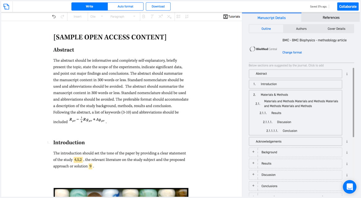
Available only on desktops 🖥

No word template required

Typset automatically formats your research paper to Journal of Hydrometeorology formatting guidelines and citation style.
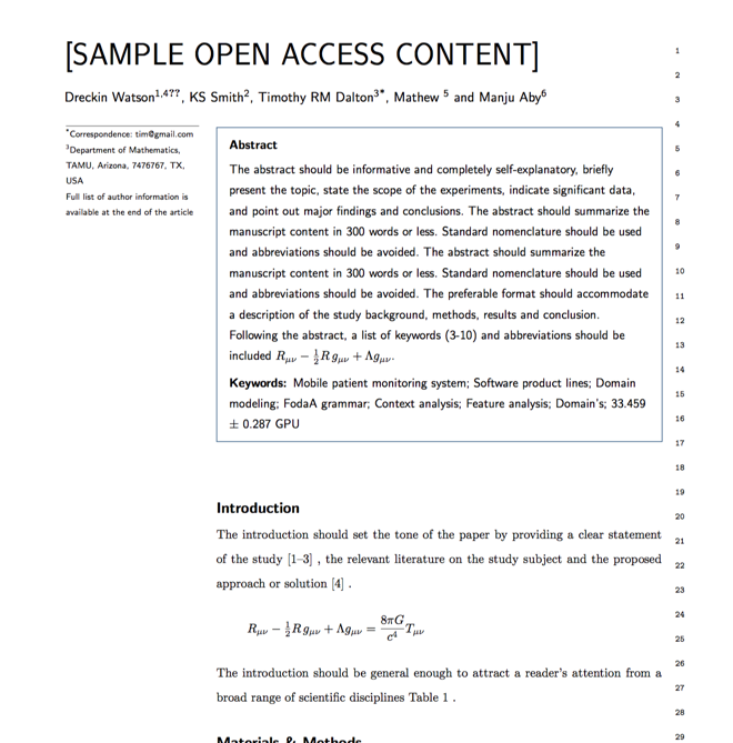

Verifed journal formats

One editor, 100K journal formats.
With the largest collection of verified journal formats, what you need is already there.

Trusted by academicians

I spent hours with MS word for reformatting. It was frustrating - plain and simple. With SciSpace, I can draft my manuscripts and once it is finished I can just submit. In case, I have to submit to another journal it is really just a button click instead of an afternoon of reformatting.

Andreas Frutiger
Researcher & Ex MS Word user
Use this template